


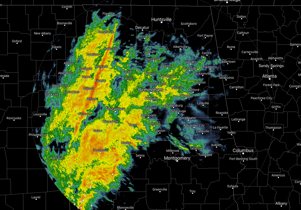
While there is a big shield of light to moderate rain over mainly the western half of the area and extending into the northeastern parts, there is a squall line with heavier rain, brief gusty winds, and a clap of thunder or two making its way eastward through the western parts. It is moving slowly to the east while the individual cells within the rain shield are moving to the northeast.
At this point, there are no severe weather watches in effect throughout the area, but a Wind Advisory is in effect for the entire area. The Wind Advisory is in effect until 2:00 pm CST this afternoon for Fayette, Greene, Hale, Lamar, Marion, Pickens, Sumter, Tuscaloosa, Walker, and Winston counties… until 6:00 pm CST this evening for Autauga, Bibb, Blount, Calhoun, Cherokee, Chilton, Coosa, Dallas, Etowah, Jefferson, Lowndes, Marengo, Perry, Shelby, St. Clair, and Talladega counties… and until 10:00 pm CST tonight for Barbour, Bullock, Chambers, Clay, Cleburne, Elmore, Lee, Macon, Montgomery, Pike, Randolph, Russell, and Tallapoosa counties.
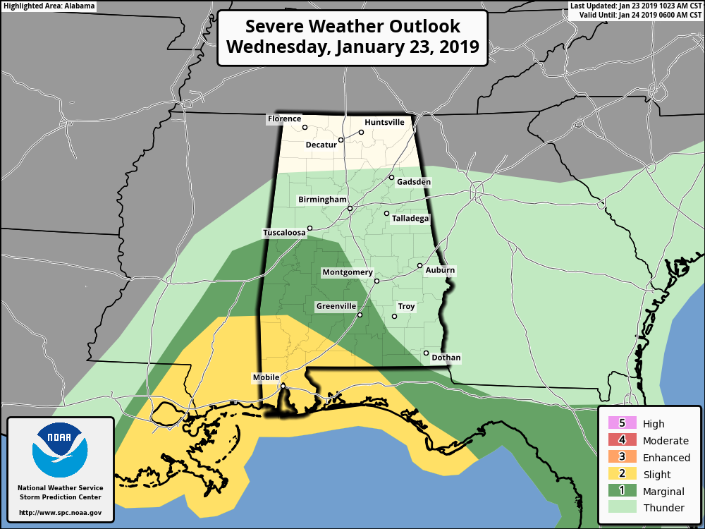
The Storm Prediction Center has a Marginal Risk defined for south-central and southwestern parts of Central Alabama throughout the day today, including the cities of Aliceville, Moundville, Brent, Selma, Fort Deposit, Marion, and Dempolis.
The main threat from the potential severe weather will be from isolated damaging winds up to 60 MPH, but a brief spin-up tornado cannot be ruled out. The time frame for potential severe weather will be from now to 6:00 pm in the Marginal Risk locations.
Instability values look to be low throughout the day but we will have just enough along with enough shear and forcing along the cold front that a few isolated damaging straight-line wind gusts will be possible. While the tornado threat is not great, a weaker isolated brief spin-up may be possible.



