


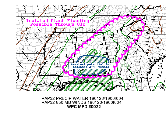
The latest Mesoscale Precipitation Discussion from the Weather Prediction Center states that nearly all of Central Alabama will continue to have moderate to heavy rainfall over the next several hours that may lead to localized flash flooding. The higher risk of flash flood issues will be over the southern half of the area where rainfall amounts could reach as high as 3.00-4.00 inches, where the rest of the area should see totals around 1.00-2.00 inches.
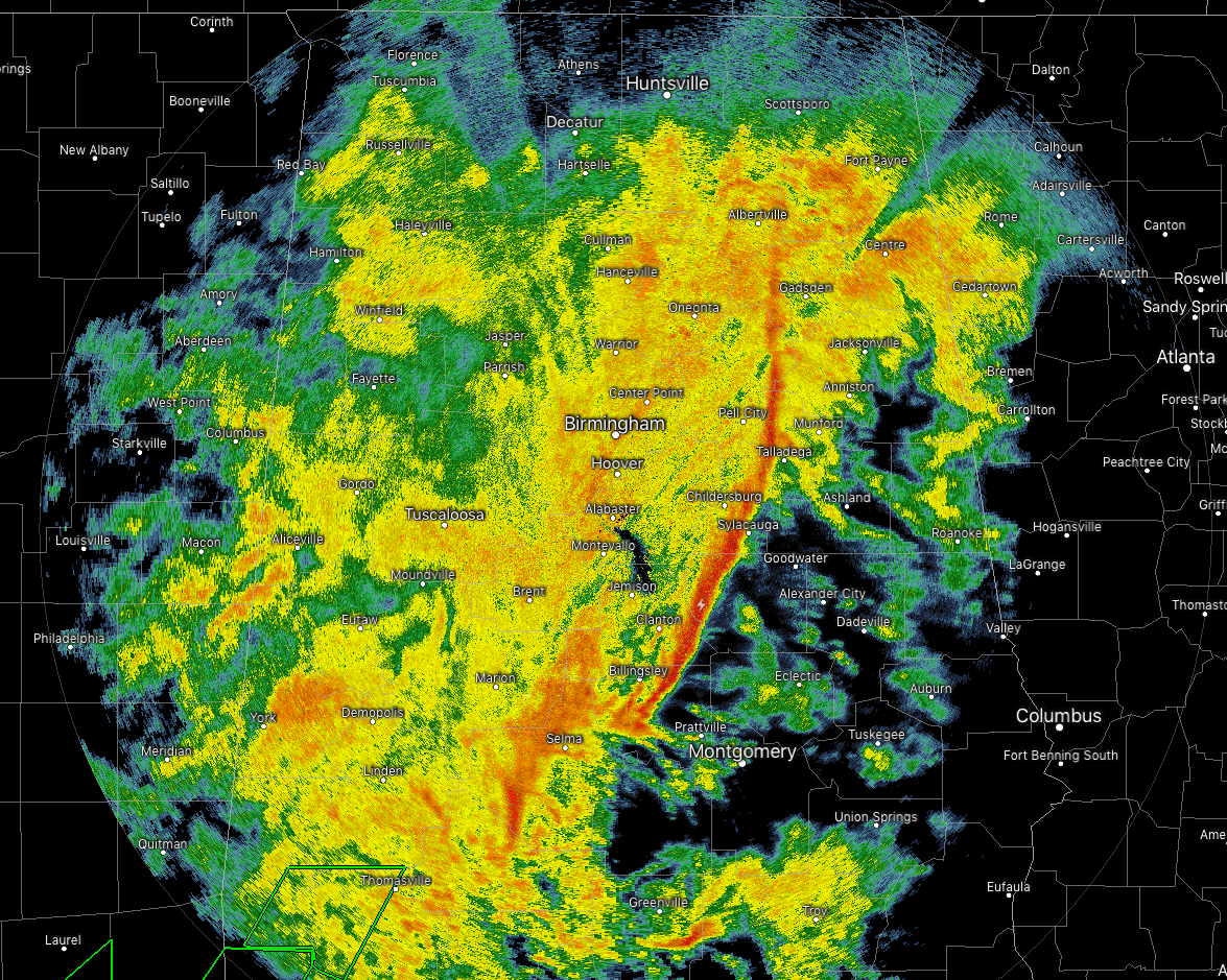
As of 3:00 pm, we continue to have much of Central Alabama cover in moderate to heavy rainfall with the exception of the southeastern parts of the area. The main squall line is stretching from just west of Gadsden to Sylacauga to just north of Autaugaville. Not a lot of lightning with this line, but brief gusty winds and very heavy rainfall is occurring. Behind that line, we still see a rain shield with moderate rainfall stretching all of the ways back to the Mississippi state line.
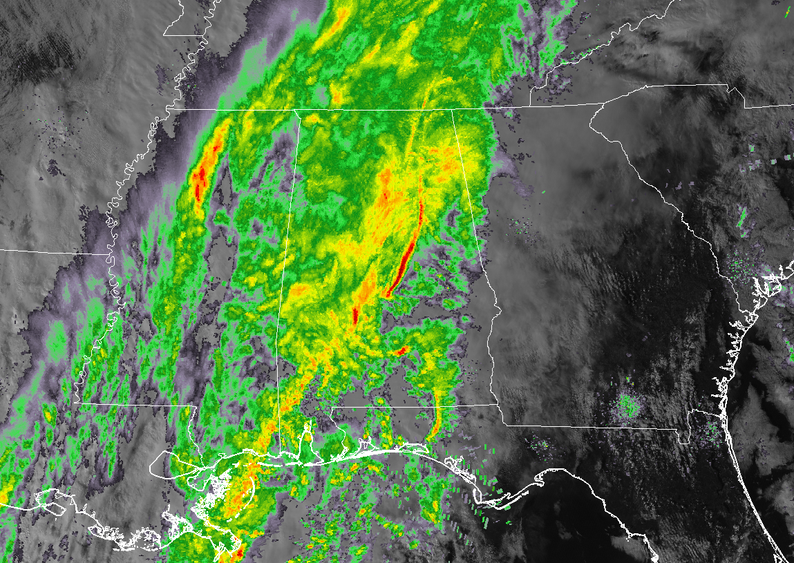
Looking back to our west in Mississippi, we see a few breaks in the rain shield before we reach the back edge where there is another batch of moderate to heavy rain over the northern portions of the state. That back edge is where the cold front is currently located and temperatures have already dropped into the mid to upper 30s behind it. Temperatures across Central Alabama range from the mid-50s in the northwest to the lower 70s in the southeast.
There still might be a brief changeover to snow flurries as the back edge reaches Central Alabama, but temperatures at that time will still be above freezing as the precipitation makes its exit. Tonight’s lows will eventually reach the upper 20s to the upper 30s across the area from northwest to southeast. But with much warmer and wet ground, accumulations and travel issues are not expected.



