


The Storm Prediction Center has upgraded the southeastern parts of Central Alabama to an Enhanced Risk of severe storms (level 3 of 5) throughout the day on Sunday (locations south of a line from Fort Deposit to Tuskegee to Smiths). A Slight Risk (level 2 of 5) continues for locations south of a line from Geiger to Pelham to Heflin. A Marginal Risk (level 1 of 5) continues north of that up to a line from Hamilton to Eva to Fort Payne.
The main window for stronger to severe storms will begin around 12:00 pm Sunday and will go until around 9:00 pm. Main threats will be from damaging thunderstorm wind gusts up to and exceeding 60 MPH and a few tornadoes. Hail is also possible but not a main threat at this time.

Rain looks to enter the northwestern parts of North/Central Alabama around the 3:00 am time frame and will progress through the area until the line finally makes it out of the area around 9:00 pm. As you will notice that there will be a line of storms with storms developing out ahead of the line during the late morning hours, but as the afternoon progresses and the dynamical support moves off to the east, it will transition into more of a linear event.
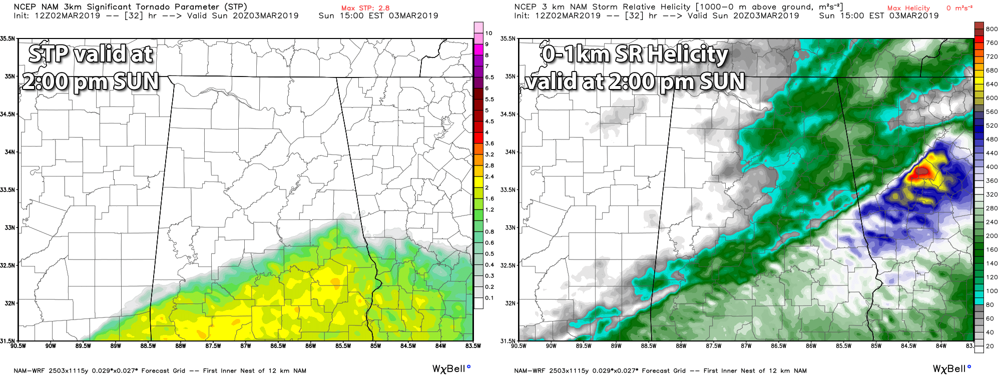
While we’ll have the threat of damaging winds and a few tornadoes across all of Central Alabama, the higher threat looks to be south of a line from Demopolis to Billingsley to Roanoke. That is where the higher helicity values and significant tornado parameter values are projected to be during the afternoon hours.
All of this will be dependent on actually how far the warm front makes it up to the north before the low moves in with the cold front and forces it back out of the area. The stronger storms will be along and south of the warm front. There could be a few strong storms north of the warm front, so that is why the northern parts of the area are defined in a Marginal Risk.
At this point, highs will be in the mid-50s to the mid-60s north of the I-20 corridor with upper 60s to the mid-70s likely south of that. Once again, the location of these temperatures could change according to how far north the warm front makes it.
Once the cold front makes it through the area, temperatures will drop quickly as overnight lows will be down in the lower 30s to the lower 40s. No worries about snow flurries on the back edge as all precipitation will be out of the area before the colder air arrives.
Stay weather aware and check back for forecast updates on the blog.



