


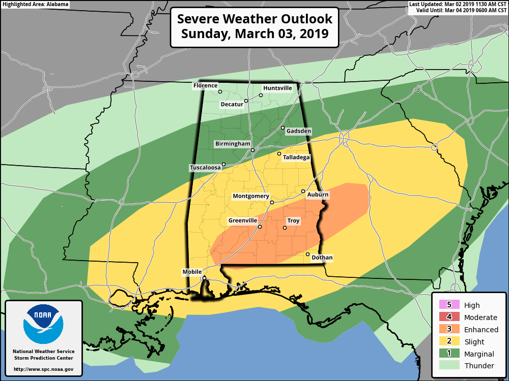
The Storm Prediction Center continues an Enhanced Risk of severe storms (level 3 of 5) throughout the day on Sunday for locations south of a line from Fort Deposit to Tuskegee to Smiths, a Slight Risk (level 2 of 5) for locations south of a line from Geiger to Pelham to Heflin, and a Marginal Risk (level 1 of 5) north of that up to a line from Hamilton to Eva to Fort Payne.
There are still some inconsistencies with the movement of the warm front to the north on Sunday and exactly how far it will move northward before the low and the cold front pushes it out of the area. At this point, the farthest north that the models are showing the warm front making it is just a few miles south of the I-20 corridor.
The greater risk of severe storms will be south of the warm front, that is why there is a slight and enhanced risk defined south of the I-20 corridor. Damaging winds up to and exceeding 60 MPH and a few tornadoes are possible across those areas. While the threat is lower in the marginal risk area, isolated damaging wind gusts up to 60 MPH and a brief spin-up tornado may be possible.
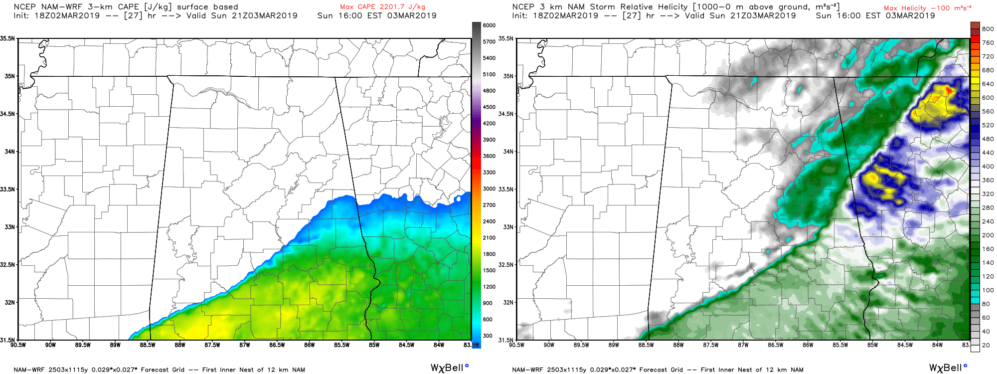
The latest run of the NAM continues to show the better values of instability (left) and helicity (right) over the southern portions of the area, with the highest values showing up around 3:00 pm. Significant tornado parameter is topping out at 3.5 at the same time over the same locations as well which is a little concerning. Any value over 1.0 means that conditions are there to support significant tornadoes.
The general timing of the severe storms continue to be from 12:00 pm to 9:00 pm across Central Alabama from northwest to southeast before the line pushes out and much colder air starts to filer in behind the cold front. Timing could change as the main line of storms and the cold front will transition from a more north to south orientation to a more flatter east to west orientation before exiting.
1.00-2.00 inches of rainfall is expected to fall across the area with the higher totals over the southern half of the area, but the good news is that rainfall will not be prolonged. With the saturated soils, we could see some brief flash flooding issues in the usual poor drainage areas. This rainfall may slow the recession of the river flooding issues, but it will not add to the problem.
Stay weather aware and check back for forecast updates on the blog.



