


We continue to have the potential of strong to severe storms across North/Central Alabama at this midday update. Ingredients continue to be there in the models for the possibility of damaging winds and tornadoes mainly during the 1:00 pm to 1:00 am time frame. Along with that, we also have gusty winds out ahead of the approaching system due to the tightening pressure gradient. A Wind Advisory is in effect for the northern half of the state through the rest of the daylight hours today.
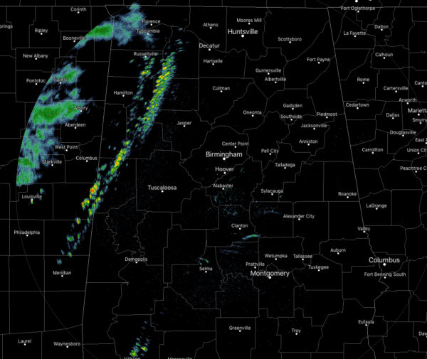
At 11:25 am, we have some scattered showers that have moved into the western portions of the area, but these are well below strong limits at this point. These may actually help mix the clouds and help warm the atmosphere to make instability values rise.
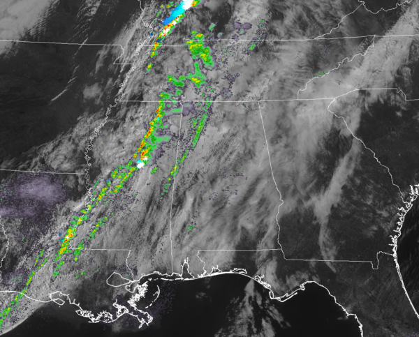
The strongest activity is currently well to our north up in Kentucky and Indiana, where we have already seen one tornado causing damage in the Padukah area. The line of storms to our west has continued to weaken throughout the morning, but with the heating of the day, more storms are expected to develop with the heating of the day and as the instability rises.
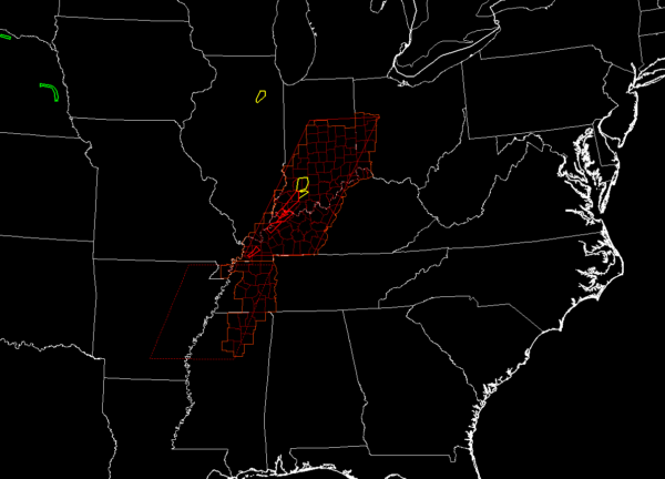
Tornado watches are up for parts of Ohio, Indiana, Illinois, Kentucky, Tennessee, Arkansas, and Mississippi. More than likely, we will see a Tornado Watch issued for parts of North/Central Alabama within the next few hours.
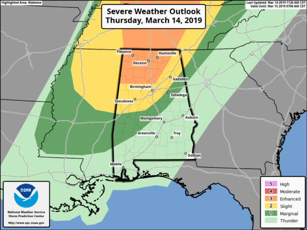
The Storm Prediction Center continues has expanded the Enhanced Risk of severe storms for a good chunk of North Alabama to include locations north and west of a line from Vernon to Morris To Susan Moore to Scottsboro. A Slight Risk extend out to include locations north of a line from Boligee to Calera to Lincoln to Centre. A Marginal Risk extends south from that to a line stretching from Selma to Rockford to Fruithurst.
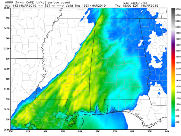
Instability values will be highest along the AL/MS state line at the 2:00 pm hour according to the latest run of the HRRR model. We are still seeing values topping out over 2,000 J/kg.
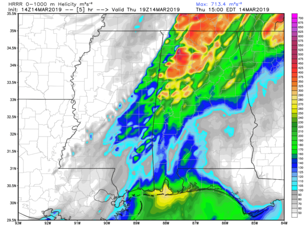
Helicity values are very high out just ahead of the higher instability at the same time, with values maxing out well above 400 m2/s2. The highest bullseye number on this map is over 700 m2/s2.
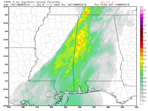
Significant Tornado Parameter values max out around this same time frame as well, with numbers at and above 3.0 being seen along and just east of the state line.
All of this to say that the ingredients are there for severe storm development with damaging winds and tornadoes possible. If the cloud cover stays in place and keeps the atmosphere a little cooler, it will be harder for the instability to build and for thunderstorms to develop. If any sunshine makes it through the cloud deck, that will allow for more warming and more instability.
Some school systems have decided to let out early today before the storms make it into the area. For a list of those closings, CLICK HERE to see the latest.
We’ll continue to have updates throughout the day.



