


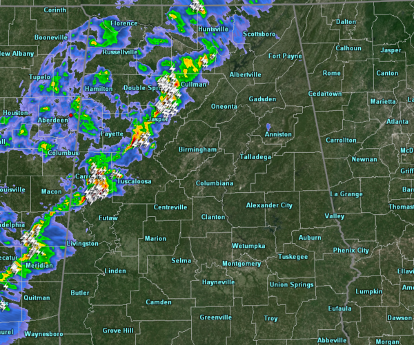
The main line of storms has now pushed well into the north-central and western parts of North/Central Alabama as of 9:35 pm. The line currently stretches from Hytop back to the southwest through Jasper and into Aliceville before crossing the AL/MS state line. Winds in excess of 40 MPH can be expected with some of these stronger storms to go along with plenty of cloud to ground lightning. If you are in the path of these stronger storms, get inside until the storms pass. Eventually, the line will start to weaken as instability continues to drop and the air becomes more stable as we cross over into the late night hours and the line moves farther east into the area.
One thing you will notice will be the temperatures dropping after the line passes your location. The cold front is just behind the line of storms. Currently, it is 68 degrees in Birmingham, but already down to 50 degrees in Haleyville. We’ll see overnight lows down into the lower 40s to the upper 50s across the area.
We’ll continue to keep you posted until the threat of severe storms passes.



