


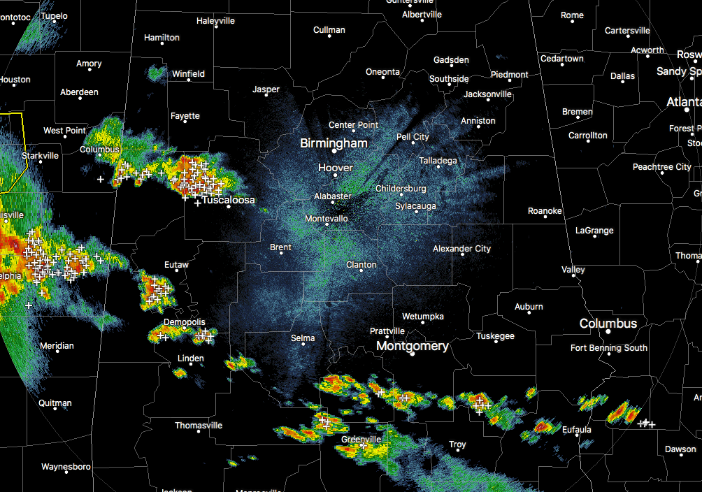
Radar at 6:00 pm is showing some scattered thunderstorms across the southern half of the area along with some over Tuscaloosa and Pickens counties. Plenty of lightning is occurring with these storms as they slowly push off to the north-northeast at 15-25 MPH. At this point, none of the storms are showing any severe characteristics, but some of these look strong with very heavy rainfall.
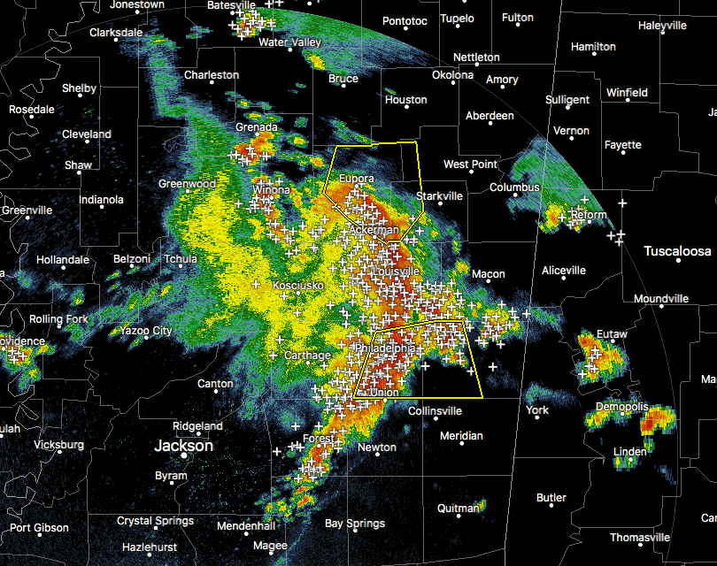
We also need to pay attention to an MCS that is moving towards Central Alabama that has the potential for strong winds. There are currently two severe thunderstorm warnings in effect for both the north end and the south end of the line and is showing a good bowing profile to it, especially from Eupora to Louisville to Philadelphia to Forest. This is putting down plenty of cloud-to-ground lightning and very heavy rainfall to go along with winds up to 60 MPH and quarter-size hail. The MCS is moving to the northeast at 60 MPH. It will be moving into the western parts of Central Alabama within the next 60-90 minutes.
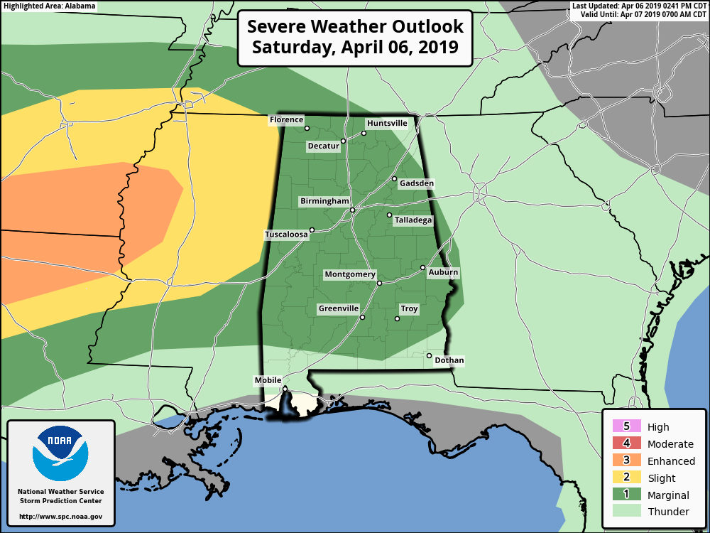
We continue to have a Marginal Risk of severe storms in place for nearly all of North/Central Alabama with the exception of the northeastern corner of the state. The severe threat continues for the southern half of the area (south of Clanton) through the next hours, and continues from now until midnight for the northern half.
We’ll keep you posted throughout the evening.



