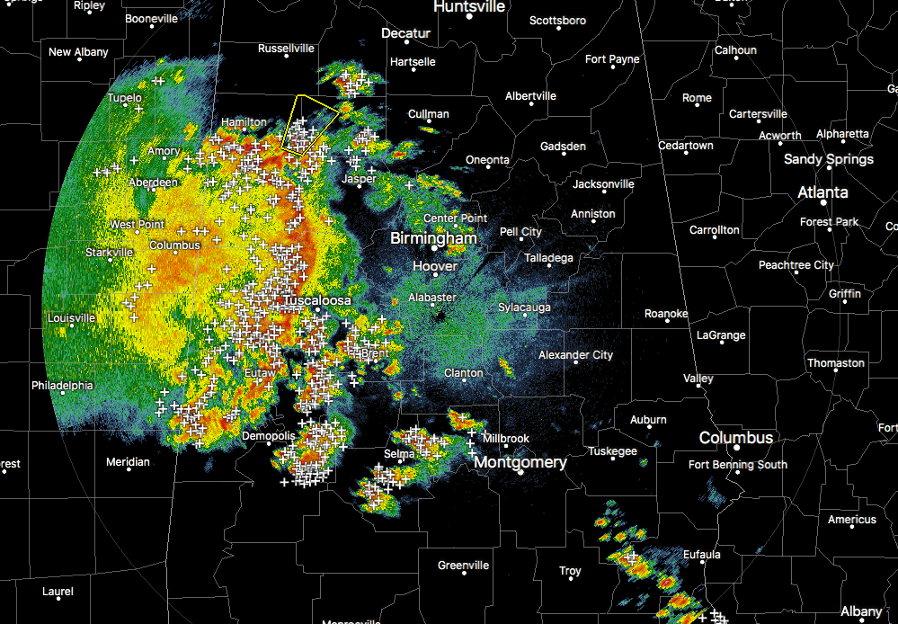
At 8:00 pm, an MCS is pushing across the western portions of Central Alabama with a Severe Thunderstorm Warning in effect on the north end of the line for Marion and Winston counties until 8:30 pm. If you are in the path of this whole system, please get indoors as there is plenty of dangerous cloud-to-ground lightning and strong wind gusts occurring.
Convective activity in the southern parts of the area is really starting to drop off as all of the action is really transitioning to the MCS.
NWS Birmingham is suspecting that 1″-1.5″ hail is falling in the cell just west of Natural Bridge.
Quarter-size hail has also been reported in Berry.
This line of storms is moving to the east-northeast at around 30 MPH and should be entering the Tuscaloosa in the next few minutes and into the Birmingham area within the next hour or so.