


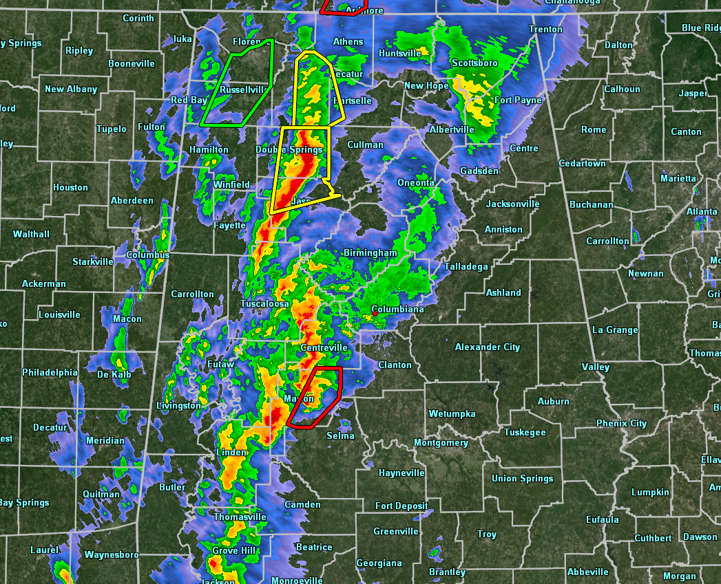
At 2:50 am, strong to severe storms continue to move eastward across the west-central parts of North/Central Alabama with plenty of lightning and strong winds with the line.
A Tornado Warning is currently in effect for Perry County until 3:30 am for a cell located near Marion that could be possibly producing a tornado and is moving to the northeast at 50 MPH.
Severe Thunderstorm Warnings are in effect for Walker and Winston counties until 3:15 am, along with a new one that was just issued for parts of Cullman, Lawrence, Limestone, and Morgan counties until 3:30 am.
Instability is starting to weaken across the area but continues to be in the 500-1000 J/kg range, enough to sustain current active thunderstorms. Bulk shear values continue to be rather strong ranging from 60-70 knots. Helicity is still rocking along at 300-650 m2/s2. STP values are still up in the 2.0-3.0 range across much of the area. All of this means that the severe storm threat continues for all of North/Central Alabama along and ahead of the line of storms.
More counties have been canceled from the 1st tornado watch, including Fayette, Greene, Hale, Marengo, and Tuscaloosa counties. The tornado watch has been extended until 5:00 am for Bibb, Blount, Jefferson, Perry, Shelby, Walker, and Winston counties.
The 2nd tornado watch continues until 9:00 am for Autauga, Calhoun, Cherokee, Chilton, Clay, Cleburne, Coosa, Dallas, Elmore, Etowah, Lowndes, Montgomery, St. Clair, Talladega, Tallapoosa, Jackson, and Dekalb counties.
We’ll continue to have updates throughout the event.



