


By Scott Martin and Bill Murray
While there remains the possibility of some strong winds behind the leading line of storms, the activity looks to be really weakening at this time. NWS Birmingham has decided that they will not be drawing up severe thunderstorm warning unless absolutely necessary from this point on.
With that being said, we still have several severe thunderstorm warnings for the central and north-central parts of North/Central Alabama for the threat of isolated damaging wind gusts up to 60 MPH. A brief spin-up tornado may be possible but the threat for those are becoming lower.
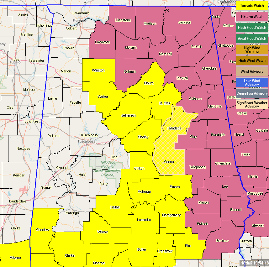
A Tornado Watch continues for Autauga, Blount, Chilton, Coosa, Dallas, Elmore, Jefferson, Lowndes, Montgomery, Pike, Shelby, St. Clair, Talladega, Walker, Winston counties until 11:00 pm tonight. Bibb, Fayette, Hale, Marengo, Marion, Perry, and Tuscaloosa counties were just removed from the watch as the severe threat is now over for those locations.
A Severe Thunderstorm Watch continues for Barbour, Bullock, Calhoun, Chambers, Cherokee, Clay, Cleburne, Etowah, Lee, Macon, Randolph, Russell, and Tallapoosa counties in Central Alabama, and for Cullman, DeKalb, Jackson, Lawrence, Limestone, Madison, Marshall, and Morgan counties until 3:00 am Sunday.
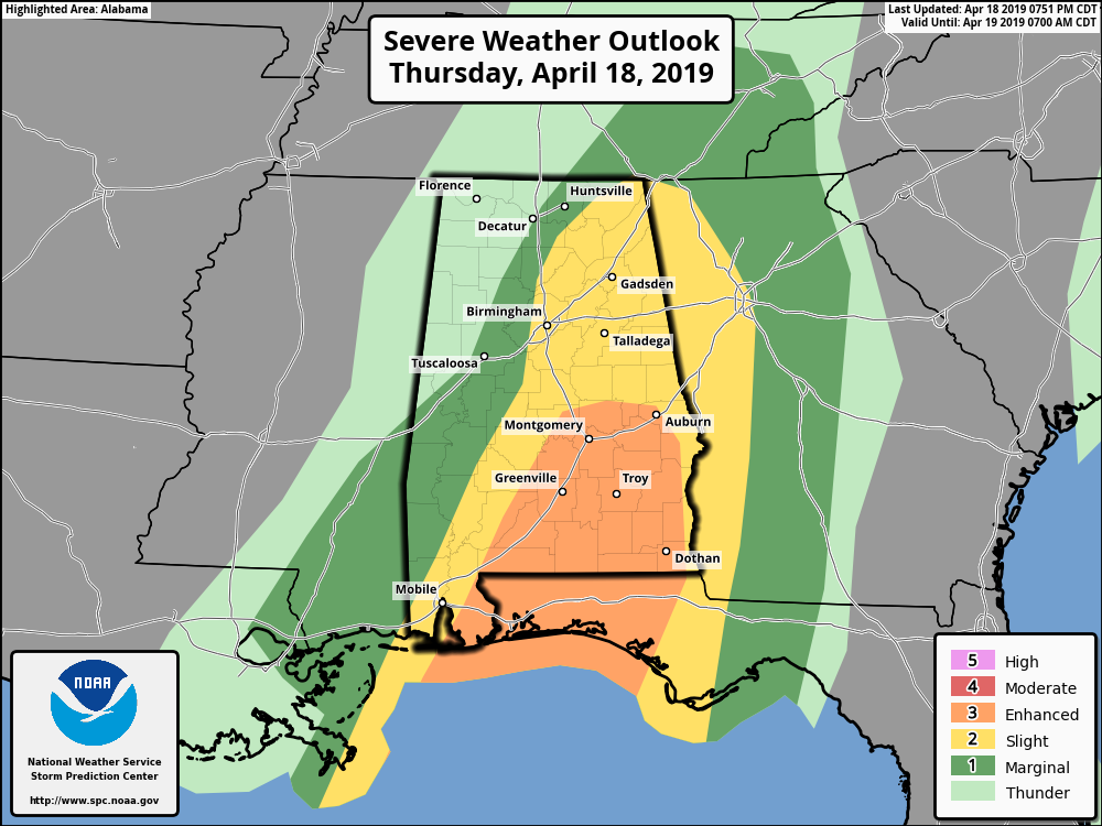
SPC has reduced the severe risks to mainly across the eastern half of North/Central Alabama throughout the rest of tonight and into the early morning hours on Friday.
An Enhanced Risk is up for areas generally along and south of I-65 and I-65 in Alabama.
A Slight Risk is up for locations east of a line from Hytop to Cullman to Thomasville in Marengo County.
Here is the radar at 8:20 p.m.:
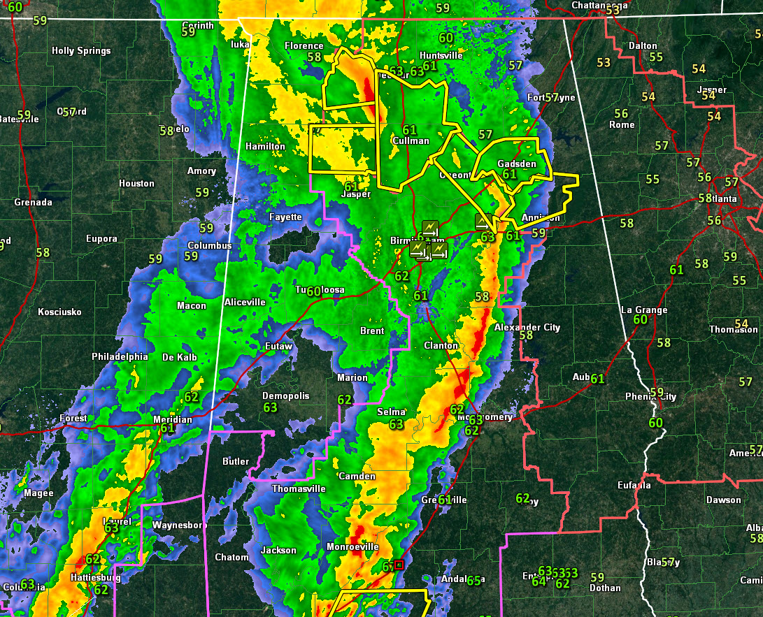
The Mesoscale Convective Complex will continue to shift northeast, weakening as it goes. It will still be capable of producing damaging winds and downing trees over the next couple of hours. The tornado threat has diminished considerably but is still there.
Most of the lightning is over southern Alabama, but there is some lightning all across the northern half of Alabam, even away from the mesoscale system.
The surface low is somewhere east of Greenwood MS at this hour. It is hanging around at about 1000 millibars. It will be near Dayton, Ohio by sunrise.
Our deep upper trough is closing off into an upper low that will bring us some dreary weather tomorrow.
Winds will remain gusty through much of tomorrow. Highs tomorrow will be in the 50s with a good chance of light rain and drizzle. The showers will diminish tomorrow night. Lows will drop into the 40s.
Saturday will be a sunny day, but highs will struggle to get into the lower 60s. 70s will return by Sunday.



