


The Storm Prediction Center continues to have nearly all of the Central Alabama area in a Slight Risk (level 2 of 5) for severe storms during the day on Saturday, with the extreme northwest corner and the extreme southeast corner of the area in a Marginal Risk (level 1 of 5). The main window for stronger to severe storms across the area will be from roughly 1:00 pm to 10:00 pm on Saturday.
This is not a typical Springtime severe weather setup, but more of one that you would see during the beginning of Summer. Damaging winds will be the main threat, while the threat for hail will be low.
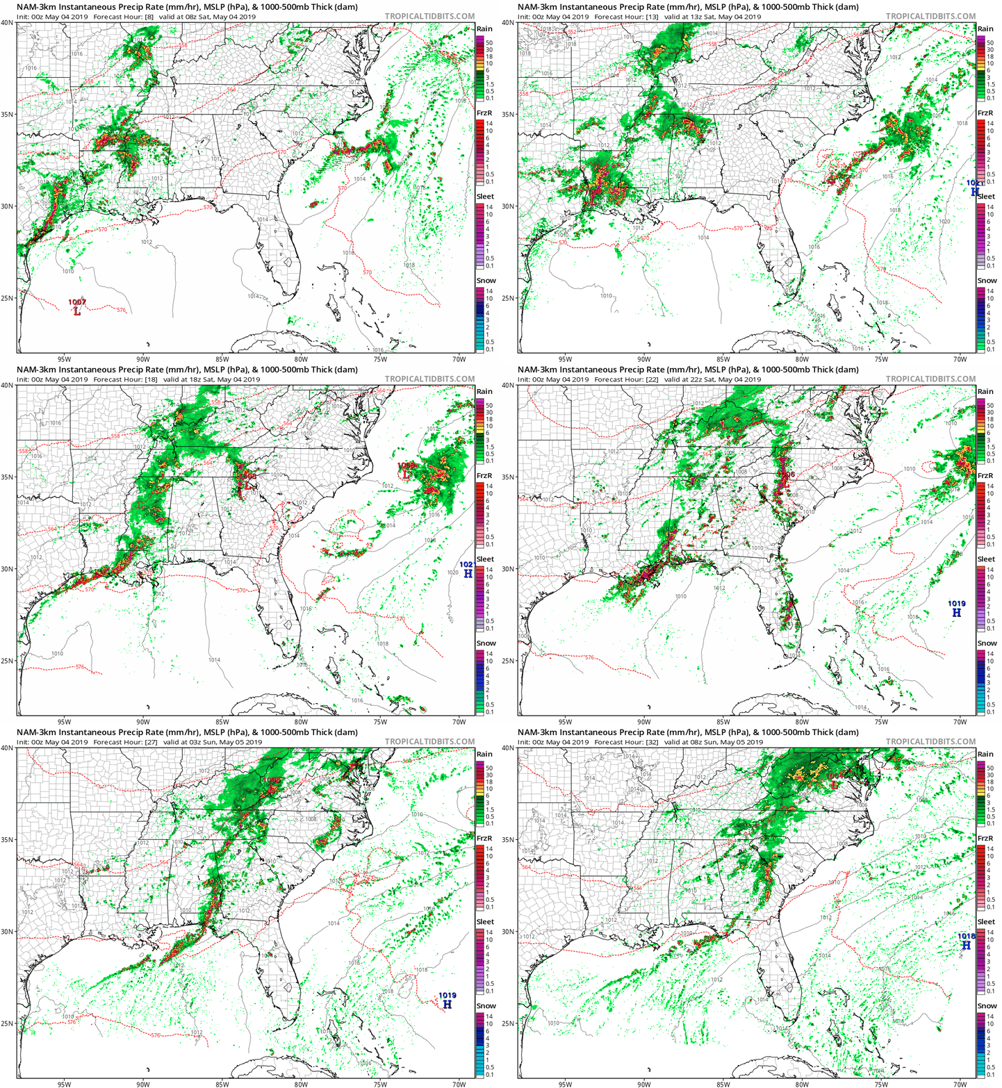
The latest run of the high-resolution NAM shows a round of showers and storms moving in during the pre-dawn hours early on Saturday morning around 3:00 am and moving through the northern parts of the area through the noon hour, staying north of the I-20 corridor. These may be noisy with thunder, but these are not expected to be severe.
By 2:00 pm, more storms will move into the area from the west in the form of an unorganized and ragged line. By this time, there is the potential for strong to severe storms, with damaging winds up to 60 MPH being the main threat. There will be a smaller threat of quarter-size hail with these storms. While the tornado threat is not zero, they are not expected as the winds will be unidirectional.
Storms will be exiting the state and moving into the western parts of Georgia by 11:00 pm Saturday night. A few lingering showers and storms may move across the area after that, but these will be much less in coverage and not strong or severe.
We’ll have to watch for the development of any cells out ahead of the line after 1:00 pm as conditions will become more favorable for the development of strong to severe storms… but, do we have a limiting factor in play? This latest run is showing much more activity forming along the Gulf Coast and up into the southern parts of the state, keeping much of the energy confined to those locations. The extreme southern locations look to have the higher chance of stronger storms, south of the US-80 and I-85 corridors.
We’ll have to wait and see if this happens. If it does, the potential for severe storms in the northern 2/3rds of Central Alabama will be much less. If it doesn’t pan out like the model run, all of Central Alabama will have the potential for strong to severe storms.
While this is a lower-end threat to Central Alabama, it is still the Spring Severe Weather Season for the area. Be prepared and have your kits and safe place ready just in case you go under a warning. Treat a severe thunderstorm warning as a tornado warning. Deaths and injuries can occur in severe thunderstorms. I’ll have updates throughout the day on Saturday starting with the Weather Xtreme Video out by 8:00 am.



