


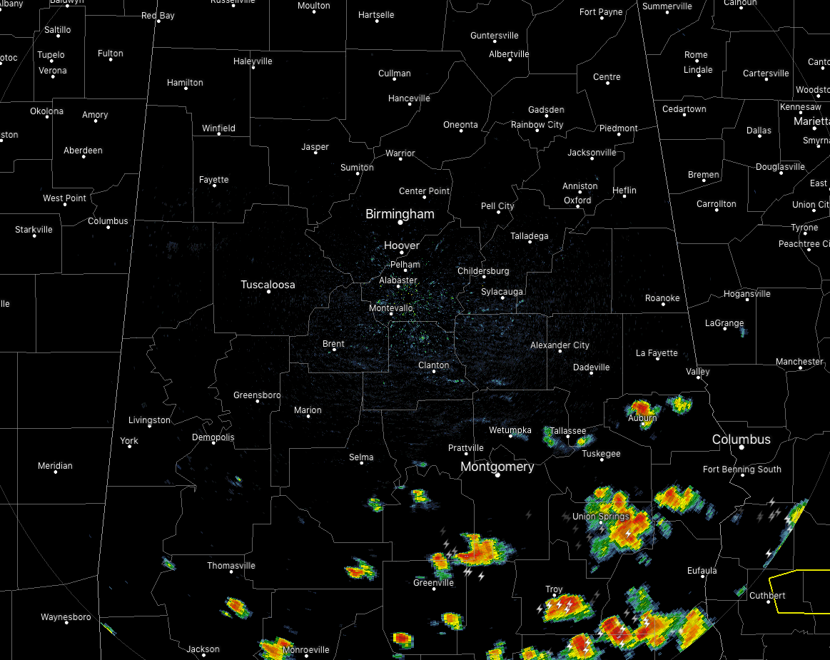
At 4:05 pm, we have scattered showers and thunderstorms mainly over the southern and southeastern parts of Central Alabam while the rest of the area is free from rain. A few of these storms are packing a punch, especially one that is over Macon and Bullock counties where gusty winds in excess of 40 MPH are possible. This storm is moving to the east at 40 MPH. Take cover if you are located in Union Springs, Hardaway, Shopton, Aberfoil, Davisville, Franklin Field, Sedgefield, Three Notch, Mitchell, Simsville, High Ridge and Fort Davis.
The rest of the shower and thunderstorm activity across the southern parts of the area are not strong at the moment.
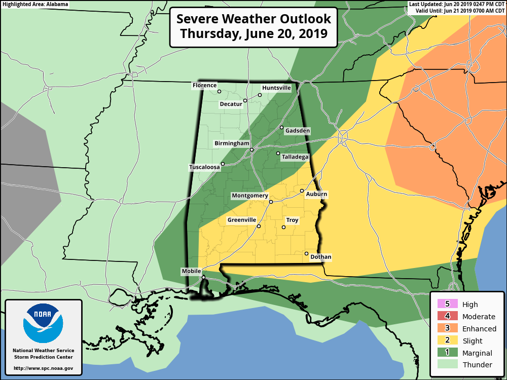
A Slight Risk for severe weather continues across the southern and southeast counties of Central Alabama this afternoon and tonight through 9:00 pm. The higher chances for strong to severe storms will be along and southeast of a line from near Demopolis to near Alexander City. The primary threats are large hail up to golf ball size and damaging winds up to 60 mph.
Current instability values across the area are ranging from 1500-3500 J/kg from north to south. Bulk shear values in the Slight Risk areas are currently in the 30-40 knot range. Some of these cells could take on a supercellular structure if they grow stronger to severe. Storms could start to rotate broadly with stronger updrafts allowing for larger hailstones to develop. There is also a non-zero tornado threat with today’s setup, but it would be very difficult for a brief spin-up to form. As with thunderstorms in Central Alabama, you will have to expect the unexpected.
We’ll keep you posted throughout the rest of the evening and into the night.



