


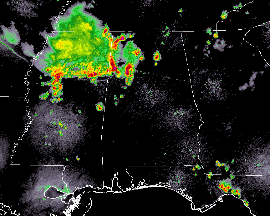
At 1:25 pm, an MCS moving southeastward through Mississippi has crossed over the MS/AL state line and will have the potential of strong gusty winds over 40 MPH and could briefly become severe up to 60 MPH. Several severe thunderstorm warnings are in effect across North/Central Alabama at this point due to the potential of damaging winds.
NWS Birmingham has released an update expanding their Marginal Risk zone to include locations northwest of a line from Gadsden to Centreville to Linden. Damaging winds up to 60 MPH and quarter size hail will be possible throughout the rest of the afternoon and into the evening hours in the risk locations.
We have already received reports of tree damage from earlier with severe storms, so don’t take these storms lightly. If a storm is approaching our location, take cover immediately.



