…THE SEVERE THUNDERSTORM WARNING FOR NORTHEASTERN DEKALB COUNTY
WILL EXPIRE AT 515 PM CDT…
The storm which prompted the warning has weakened below severe
limits, and no longer poses an immediate threat to life or property.
Therefore, the warning will be allowed to expire. However small
hail, gusty winds and heavy rain are still possible with this
thunderstorm.
LAT…LON 3450 8555 3450 8556 3449 8556 3449 8557
3459 8579 3475 8569 3475 8566 3469 8554
3453 8551
Severe Thunderstorm Warning Issued For Parts Of Dekalb County Until 5:15PM
Jun 27th @ 4:50 pm
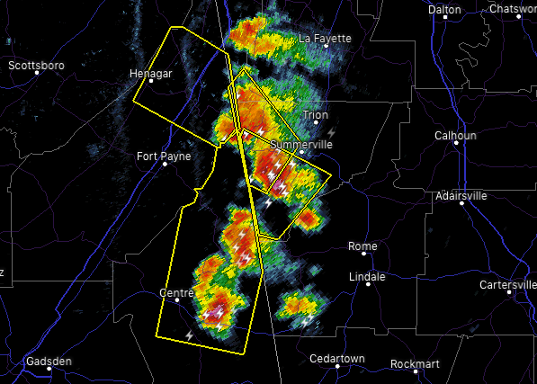

The National Weather Service in Huntsville Alabama has issued a
* Severe Thunderstorm Warning for…
Northeastern DeKalb County in northeastern Alabama…
* Until 515 PM CDT.
* At 450 PM CDT, a severe thunderstorm was located 8 miles northwest of Summerville, moving northwest at 10 mph.
HAZARD…60 mph wind gusts and quarter size hail.
SOURCE…Radar indicated.
IMPACT…Hail damage to vehicles is expected. Expect wind damage to roofs, siding, and trees.
* Locations impacted include…
Henagar, Ider, Valley Head, Hammondville, Mentone and Sulpher
Springs.