


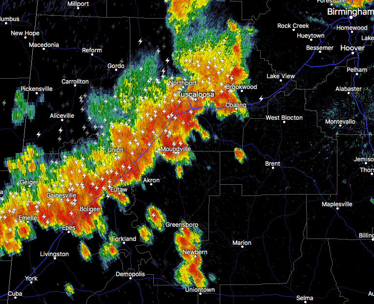
Special Weather Statement
National Weather Service Birmingham AL
528 PM CDT Tue Aug 27 2019
ALZ023-032-034-272330-
Hale AL-Bibb AL-Tuscaloosa AL-
528 PM CDT Tue Aug 27 2019
…SIGNIFICANT WEATHER ADVISORY FOR SOUTHEASTERN TUSCALOOSA…HALE
AND BIBB COUNTIES UNTIL 630 PM CDT…
At 528 PM CDT, Doppler radar was tracking strong thunderstorms along
a line extending from Lake Wildwood to near Epes. Movement was
southeast at 25 mph.
Dime size hail and winds in excess of 40 mph will be possible with
these storms.
Locations impacted include…
Southeastern Tuscaloosa, Brent, Centreville, Greensboro, Holt,
Moundville, Lake View, Brookwood, Coaling, Vance, Woodstock, West
Blocton, Akron, Newbern, McFarland Mall, Lake Wildwood, Low Gap,
Mertz, Sawyerville and Mercedes Benz Of Alabama.
PRECAUTIONARY/PREPAREDNESS ACTIONS…
Frequent cloud to ground lightning is occurring with these storms.
Lightning can strike 10 miles away from a thunderstorm. Seek a safe
shelter inside a building or vehicle.



