


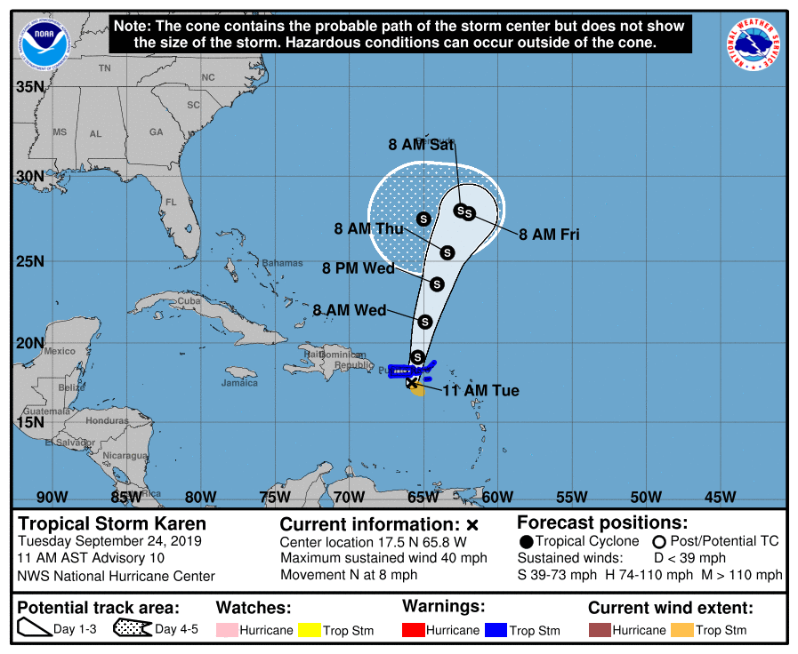
SUMMARY OF 10:00 AM CDT
LOCATION…17.5N 65.8W
ABOUT 65 MI…110 KM WSW OF ST. CROIX
ABOUT 65 MI…105 KM SSE OF SAN JUAN PUERTO RICO
MAXIMUM SUSTAINED WINDS…40 MPH…65 KM/H
PRESENT MOVEMENT…N OR 0 DEGREES AT 8 MPH…13 KM/H
MINIMUM CENTRAL PRESSURE…1007 MB…29.74 INCHES
A Tropical Storm Warning is in effect for the U.S. Virgin Islands, Puerto Rico, including Vieques and Culebra, and the British Virgin Islands.
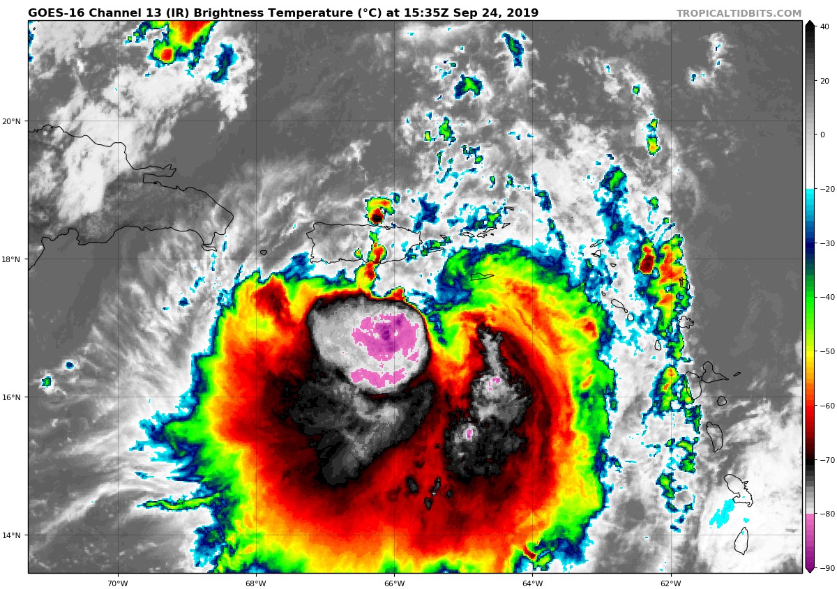
Satellite imagery and reports from an Air Force Reserve Hurricane Hunter aircraft show that there has been little change in either the structure or the intensity of Karen since the last advisory. The broad and elongated low-level center is located to the north of the strong convection, and the aircraft has reported a central pressure of 1007 MB and maximum 1500 ft flight-level winds of 35 kt south of the center. The initial intensity is held at 35 kt for this advisory.
The initial motion is now 360/7. Karen is in a complex steering environment that includes a low- to mid-level ridge to the east and northeast, Tropical Storm Jerry to the north-northwest, and a large mid- to upper-level trough extending from near Jerry to eastern Cuba. These weather systems should steer Karen generally northward today, followed by a north-northeastward motion that should continue for a couple of days. This motion should bring the center of Karen near or over Puerto Rico and the Virgin Islands this afternoon, then into the open Atlantic tonight. During the 72-120 h period, the large-scale models forecast a low- to mid-level ridge to build near Karen, which will significantly slow its forward motion. The new forecast track will continue the trend of the previous forecast and the ECMWF model in showing the ridge building enough to turn Karen west-southwestward by 120 h. However, other models suggest a looping motion or little motion during the 96-120 h, and this part of the forecast track is quite uncertain.
The large-scale models forecast the shear that has been affecting Karen to diminish during the next couple of days, which should allow the cyclone to gradually strengthen. From 72-120 h, the storm is expected to start entraining dry air, which could limit intensification despite the otherwise favorable shear and sea surface temperature environment. The new intensity forecast is unchanged from the previous forecast, and it lies between the weaker dynamical models and the stronger statistical-dynamical models.
Key Messages: Karen is expected to bring heavy rainfall, flash floods and mudslides to Puerto Rico and the U.S. and the British Virgin Islands today, where a tropical storm warning is in effect. The rainfall and potential flooding will likely continue on Wednesday even as the center of Karen moves away from Puerto Rico and the Virgin Islands.



