


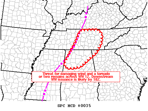
The severe weather threat for Tornado Watch 12 continues.
SUMMARY…Threat for damaging wind and perhaps a tornado or two continues across WW 12. Local watch extension will likely be needed across middle TN, and downstream watch issuance is likely by noon into northeast AL/northwest GA/eastern TN.
DISCUSSION…Extensive QLCS is ongoing across middle TN into northern AL at 9:30 am. Over the last hour, the eastward progression of the QLCS has slowed across northern AL, while some northeastward push is still noted across middle TN. Instability downstream of this system is quite meager, but sufficient to allow maintenance or only a slow weakening of the QLCS in the short term. Very strong low-level flow/shear (70-80 kt of flow at around 1 km AGL) will continue to support the potential for damaging wind and perhaps a brief tornado as the northern portion of the QLCS spreads northeastward across middle TN. A local extension of WW 12 may be necessary across TN to cover this threat in the short term, with downstream watch issuance likely into eastern TN by noon.
Further south across northern AL, the recent lack of eastward progression of the QLCS may allow for somewhat greater destabilization downstream before the system begins to surge eastward again by late morning/early afternoon. This could result in a somewhat greater wind/tornado risk later today compared to areas further north. Downstream watch issuance into northeast AL/northwest GA will become increasingly likely by noon.



