


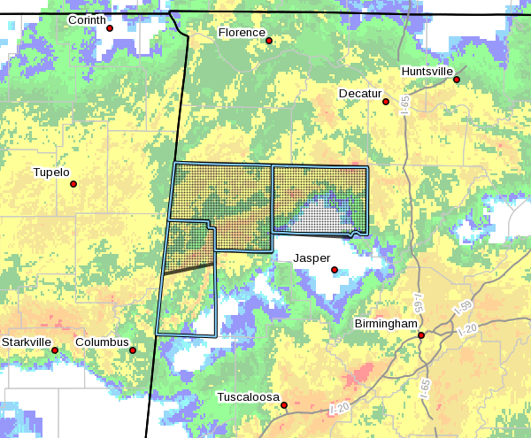
The National Weather Service in Birmingham has issued a
* Flash Flood Warning for…
Marion County in northwestern Alabama…
Winston County in northwestern Alabama…
Northern Lamar County in west central Alabama…
* Until 545 PM CST.
* At 1150 AM CST, Doppler radar indicated continued heavy rain and
thunderstorms producing heavy rain across the warned area. 2 to 3
inches of rain has been estimated by radar over the last six hours
on top of already saturated ground. Creeks and streams are likely
on the rise within the warned area, and roadways may become
impassible over the next 2 to 3 hours.
. Flash flooding is ongoing or expected to begin shortly.
HAZARD…Flash flooding caused by thunderstorms.
SOURCE…Radar indicated.
IMPACT…Flooding of small creeks and streams, urban areas,
highways, streets and underpasses as well as other
drainage and low lying areas.
* Some locations that will experience flooding include…
Hamilton, Winfield, Haleyville, Sulligent, Lynn, Arley, Guin,
Hackleburg, Double Springs, Brilliant, Addison, Glen Allen,
Detroit, Nauvoo, Beaverton, Gu-
Win, Houston Recreational Area, Camp McDowell, Nesmith and Ashbank.
PRECAUTIONARY/PREPAREDNESS ACTIONS…
Turn around, don’t drown when encountering flooded roads. Most flood
deaths occur in vehicles.
Please report flooding to your local law enforcement agency when you
can do so safely.
A Flash Flood Warning means that flooding is imminent or occurring.
If you are in the warned area move to higher ground immediately.
Residents living along streams and creeks should take immediate
precautions to protect life and property.



