


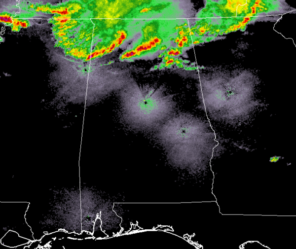
As of 2:00 am, a broken line of rain and thunderstorms continues to push southeastward through North Alabama with a couple of Severe Thunderstorm Warnings in effect for several counties in that area.
Storms are pushing into the extreme northern parts of Central Alabama with the potential of small hail and gusty winds at this point. The good news is that these storms in Central Alabama are below severe limits.
Along and ahead of the line of storms, we continue to see a decent amount of instability over the northern half of the area, running around 500-1000 J/kg. We still have a good bit of bulk shear in place, around 60-65 knots m2/s2.
NWS Birmingham has decided to hold off on the issuance of a Severe Thunderstorm Watch for parts of Central Alabama as conditions look to only be marginal at the moment.
We’ll be with you through the rest on the pre-dawn hours until the threat fades away or storms move out of the area.



