


CONDITIONS AT 12:00 PM & FORECAST FOR THE REST OF YOUR FRIDAY
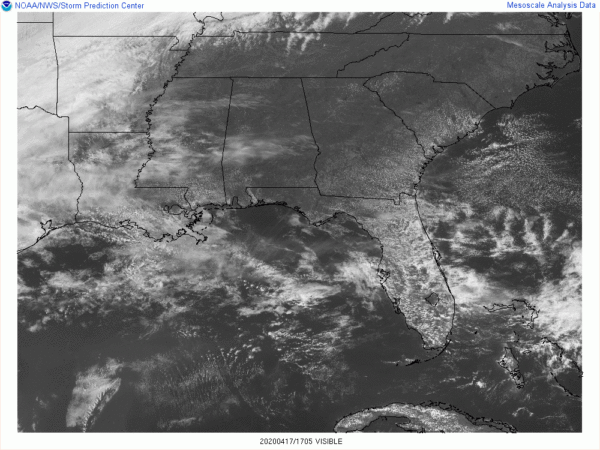
We have some clouds floating over the parts of the area at this point of your Friday, but most locations are seeing an ample amount of sunshine at midday. Temperatures as of the 12:00 pm roundup were in the upper 60s to the mid-70s across the area. The cool spots were Alexander City and Auburn at 69 degrees with fair skies. The warm spot was Troy at 74 degrees with fair skies. Birmingham was sitting at 71 degrees with partly sunny skies.
Clouds will be on the increase from the west as a cold front will be approaching the area, but we’ll continue to stay dry through sunset. Afternoon highs will be in the mid to upper 70s across the area from north to south. For tonight and through the overnight hours, the cold front will begin to move through the area bringing with it showers and a few thunderstorms especially to the northern half of the area after midnight. Rain chances will increase as the pre-dawn hours continue on for the southern half as the front continues to push through the area. Lows will be in the upper 40s to the lower 60s across the area.
POTENTIAL STARTING TO SHAPE UP FOR A SIGNIFICANT SEVERE WEATHER THREAT FOR THE SOUTHERN HALF OF THE AREA
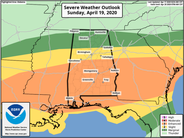
Unfortunately, this Sunday’s severe storm threat is starting to look a little like Easter Sunday’s event. The good news is that this system moving through is not expected to be as strong, but we can still see a few tornadoes, damaging winds, and some large hail.
All of Central Alabama will have a risk for severe storms on Sunday afternoon through the rest of the day and crossing over into the start of the overnight hours on Monday morning. An Enhanced Risk is up for the southern half of the area where the threats will be from tornadoes, damaging winds up to and exceeding 70 MPH, and hail up to ping pong ball size. A Slight Risk is up as far north as Sulligent (Lamar Co.) to Locust Fork (Blount Co.) to Pleasant Gap (Cherokee Co.) where the threats will be from possible tornadoes, damaging winds up to and exceeding 60 MPH, and hail up to quarter size. A Marginal Risk is up for the rest of the northern parts of the area almost to the AL/TN state line.
The similarities with this system and the one from Easter Sunday is that it looks like we’ll have multiple waves of storms affect the area throughout the day. We’ll have storms moving through the area along and north of a warm front that will be pushing through the area from south to north during the morning hours. While most of these storms should be well behaved, we may have a few strong storms with gusty winds and small hail. The overall severe threat from these storms will be very small at this point.
The second wave will be in the form of multiple clusters of storms entering the western parts of the area around or after 3:00 pm and will move westward across the area during the rest of the afternoon and into the evening and the start of the overnight hours. The strength and threat of these storms will be determined by how much the atmosphere can recover during the main heating of the day.
At this point, it looks like the better potential for severe storms will be south of a line from Millport (Lamar Co.) to Birmingham (Jefferson Co.) to Woodland (Randolph Co.) as the instability will be greatest in the southern half of the area. The northern parts of the area look to have more stable air at this point, so the overall threat will be small for those locations.
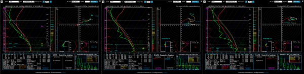
Soundings from the 12z run of the NAM-12km (Hackleburg/Birmingham/Fort Deposit). Click image to enlarge.
These soundings from the latest run of the NAM-12km model show the large difference in available ingredients for severe storms.
The Hackleburg sounding (left) shows only a marginal threat for severe storms as the instability will be very weak and helicity is below the threshold to be supportive of rotating updrafts. Isolated damaging winds would be the main threat here.
The Birmingham sounding (center) shows a much more unstable environment as instability is forecast to be over 2000 J/kg, helicity will be supportive of rotating updrafts, and lapse rates will be just steep enough. This would line up with the Slight Risk threats in the Severe Weather Outlook graphic.
The Fort Deposit sounding (right) is even a little more worrisome as conditions would be prime for a particularly dangerous situation tornado threat. Forecast instability will be near 4000 J/kg, with strong wind shear, and helicity, and lapse rates that are all favorable for that threat. On this model sounding, it is placing the significant tornado parameter at 6.2. So the threats with an Enhanced Risk line up with this sounding, but I wouldn’t be surprised if the southern parts of the area get upgraded to a Moderate Risk if we keep getting signals like this, especially with the high-resolution, convection-allowing models.
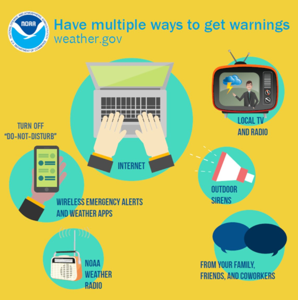
So, the bottom line is… don’t go to sleep on this system as it has the potential to be a significant severe weather event. You know the drill… Have your emergency kits fully packed, your safe place, and your severe weather action plan ready to go. We have a couple of days before the event, so you have time to prepare. Have multiple ways of receiving warnings. Do not rely just simply on outdoor sirens.
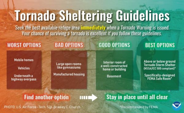
Do not attempt to ride out a tornado warning in a mobile/manufactured home or in a car. You have time to make plans to go to a more sturdy structure or a local tornado shelter. You do this, your chance of surviving a tornado is excellent, especially if you plan well ahead of the event and are ready to act if a warning is issued for your location.



