


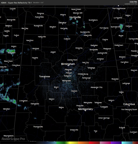
At 2:05 pm, much of the radar is clear of any shower activity, but we do note a few light showers occurring up in the northern parts of the area in parts of Marshall and Madison counties, along with light showers moving into and across portions of Sumter County. The latest round-up is not out, so temperatures at the 1:00 pm hour were in the 70s to the lower 80s across the area. Haleyville was the cool spot at 72 degrees. Birmingham was at 77 degrees. The warm spot was Selma at 81 degrees.
A few showers will remain possible over the northern half of the area through sunset, while the rest of the area will see mostly sunny skies. Afternoon highs will be in the upper 70s to the lower 80s. For tonight and through the overnight hours, we’ll have increasing clouds to start, then showers and storms will move into the area during the overnight hours just before sunrise. Lows will be in the upper 50s to the lower 60s.
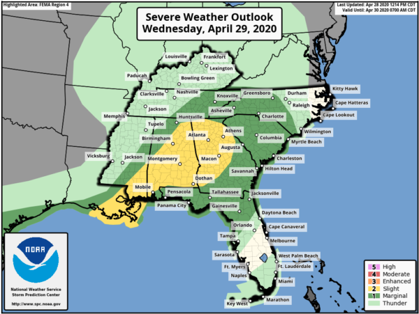
The latest update from the Storm Prediction Center shows that the LEVEL 2 SLIGHT RISK has now been expanded to cover all of the North/Central Alabama area for Wednesday with the exception of the northwest quarter. A LEVEL 1 MARGINAL RISK is up for most of those locations except the far northwestern corner of the state.
Strong to severe thunderstorms capable of producing mainly damaging winds may occur Wednesday across much of North/Central Alabama starting as early as 6:00 am on Wednesday morning in the western parts of the area and lasting possibly as late as 6:00 pm in the eastern parts.
The first round of storms will be in the form of a weakening band of rain and storms with the small potential of gusty winds and small hail. The severe threat from this line is very small, but not at zero. The second round will be where we’ll have to watch for severe storms.
Limiting factors that make this a conditional threat will be cloud cover that will limit the sunshine through the main heating of the day, along with cooler, more stable air flowing out ahead of the first round of storms as it moves in during the morning hours. Also, we’ll have to see if any storms that move along the Gulf Coast will shunt any energy from flowing up into North/Central Alabama.
The latest model guidance is showing the potential for destabilization occurring during the afternoon hours that may lead to the development of scattered showers and thunderstorms. There looks to be sufficient vertical shear and instability in place to support strong to severe storms capable of producing isolated damaging wind gusts up to 60 MPH and some hail. While there may be a very small chance of a fried tornado, the threat is not at zero. We’ll have to stay weather aware as we remain in our main severe weather season. Expect the unexpected.



