


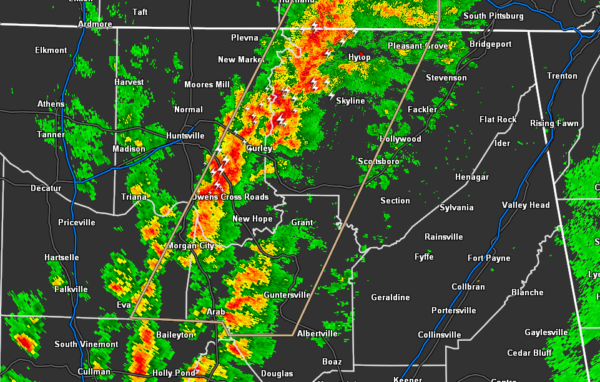
…SIGNIFICANT WEATHER ADVISORY FOR WESTERN JACKSON…MARSHALL…
EASTERN MADISON…SOUTHEASTERN MORGAN AND FRANKLIN COUNTIES UNTIL 130
PM CDT…
At 1247 PM CDT, Doppler radar was tracking strong thunderstorms along
a line extending from 9 miles north of Sewanee to near Arab. Movement
was east at 15 mph.
Pea size hail and winds in excess of 30 mph will be possible with
these storms.
Locations impacted include…
Southern Huntsville, Scottsboro, Winchester, Guntersville, Arab,
Decherd, Estill Springs, Cowan, Owens Cross Roads and Grant.
PRECAUTIONARY/PREPAREDNESS ACTIONS…
Strong gusty winds will be capable of knocking down small tree limbs
along with other small unsecured items. Seek safe shelter until this
line of storms has passed.



