


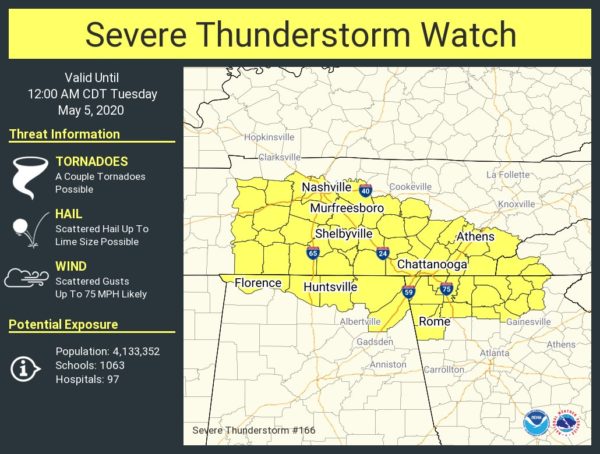
The Storm Prediction Center along with NWS Huntsville has issued a SEVERE THUNDERSTORM WATCH for Lauderdale, Limestone, Madison, Jackson, and DeKalb counties in North Alabama until 12:00 am.
POSSIBLE THREATS
• Damaging winds up to 75 MPH
• Lime size hail
• A brief tornado or two are not out of the question
SUMMARY…
Multiple storm clusters and supercells in western Tennessee will likely undergo some upscale growth through cell mergers/interactions the next few hours, with bow echo development possible. The initial supercells will pose a threat for large hail, but damaging winds will become the more substantial threat in time. A tornado or two with embedded circulations/mesovortices will also be possible, mainly across middle Tennessee this evening.
PRECAUTIONARY/PREPAREDNESS ACTIONS…
REMEMBER…
A Severe Thunderstorm Watch means conditions are favorable for severe thunderstorms in and close to the watch area. Persons in these areas should be on the lookout for threatening weather conditions and listen for later statements and possible warnings. Severe thunderstorms can and occasionally do produce tornadoes.



