


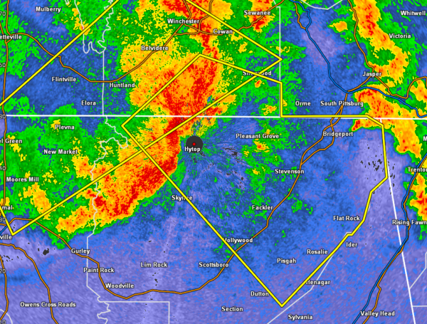
BULLETIN – IMMEDIATE BROADCAST REQUESTED
Severe Thunderstorm Warning
National Weather Service Huntsville AL
957 PM CDT Mon May 4 2020
The National Weather Service in Huntsville Alabama has issued a
* Severe Thunderstorm Warning for…
Northeastern Jackson County in northeastern Alabama…
Southeastern Franklin County in Middle Tennessee…
* Until 1030 PM CDT.
* At 957 PM CDT, severe thunderstorms were located along a line
extending from 9 miles south of Cowan to 9 miles northwest of
Skyline, moving southeast at 45 mph. This storm has a history of
producing wind damage.
HAZARD…60 mph wind gusts.
SOURCE…Radar indicated.
IMPACT…Expect damage to roofs, siding, and trees.
* Locations impacted include…
Bridgeport, Stevenson, Hollywood, Skyline, Pisgah, Anderson, Hytop,
Bass, Martintown and Jericho.
PRECAUTIONARY/PREPAREDNESS ACTIONS…
For your protection move to an interior room on the lowest floor of a
building.



