


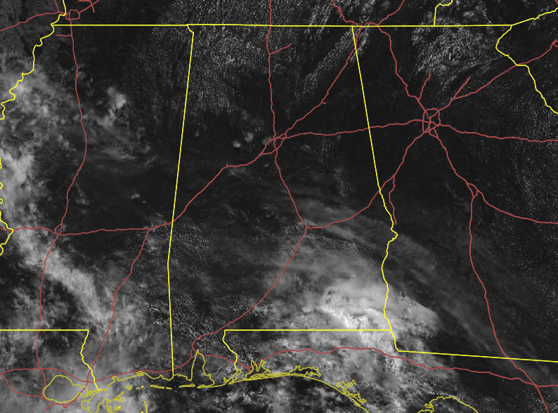
We have plenty of sunshine across the area as of 11:30 am, but we do expect some convective clouds to form and build during the heating of the day. Temperatures as of the 11:00 am roundup were in the upper 70s to the lower 80s across the area. Auburn was the cool spot at 79 degrees while Birmingham, Tuscaloosa, and Montgomery were tied at 83 degrees as the warm spots.
Skies will eventually become partly cloudy and there will be a chance of isolated to scattered showers and thunderstorms over the portions of the area south of a line from Fayette to Alexander City to Eufaula. Rain chances are higher as you move southwest. Afternoon highs will be in the upper 80s to right at or just over 90 degrees. Most of the showers will dissipate after sunset but we’ll continue to have a very small chance of isolated showers and thunderstorms mainly south of a line from Tuscaloosa to Montgomery to Troy. All rain will be over by the late local news. Lows will be in the mid-60s to right around 70 degrees.
Rain chances will increase and scattered showers and thunderstorms will be possible across all of Central Alabama during the afternoon and early evening hours on Wednesday. Skies will be partly to mostly cloudy and highs will be in the 80s across the area. Higher rain chances will be west of a line from Fayette to Clanton to Troy.
WE NOW HAVE TROPICAL STORM CRISTOBAL
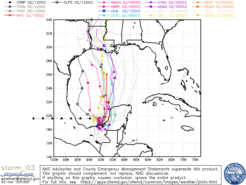
Tropical Depression Three recently was reclassified as a tropical storm after Hurricane Hunter aircraft found that maximum sustained winds have now climbed to 40 MPH. Here are the latest Key Messages from the NHC:
1. Deadly flooding has already occurred in portions of Guatemala and El Salvador, and the depression is expected to bring additional heavy rainfall to portions of southern Mexico, Guatemala, Honduras, and El Salvador, which could cause life-threatening flash flooding and mudslides.
2. Tropical storm conditions are expected along the coast of Mexico where a tropical storm warning is in effect.
3. The system is forecast to begin moving northward across the Gulf of Mexico by this weekend. However, it is too soon to specify the location and timing of any potential impacts along the U.S. Gulf Coast. Interests in these areas should monitor the progress of this system through the week and ensure they have their hurricane plan in place as we begin the season.
Model output continues to show that the highest impacts from Cristobal will be west of the Alabama Gulf Coast. However, deep tropical moisture will move northward into the Central Gulf Coast starting in about 3 to 5 days, along with an increase in the potential for rough seas and dangerous rip currents.
We’ll have numerous updates throughout the rest of the week and weekend.



