


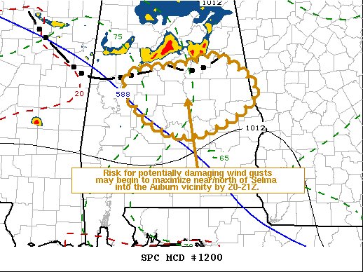
SUMMARY… Further intensification of the thunderstorm cluster overspreading central Alabama is possible into peak heating, and the risk for potentially damaging wind gusts may begin to maximize near/north of Selma into the Auburn area by 3:00-4:00 pm.
DISCUSSION… Thunderstorm intensity is being maintained along the south-southeastward advancing (30-35+ kt) conglomerate surface cold pool, particularly south and southeast of the mesoscale convective vortex which has progressed to the south of Huntsville. Modest 2-hourly surface pressure falls have become evident in 18Z (1:00 pm) surface observations, near and south of Birmingham, with roughly a 20-degree temperature gradient across the gust front.
As the pre-convective environment continues to destabilize with surface heating and boundary-layer moistening, additional intensification of storms still appears possible during the next few hours. With coinciding further strengthening of the surface cold pool, the risk for potentially damaging wind gusts may begin to maximize across south-central Alabama by 20-21Z (3:00-4:00 pm).



