


Taking a Look Out of the Window at 11:00 am
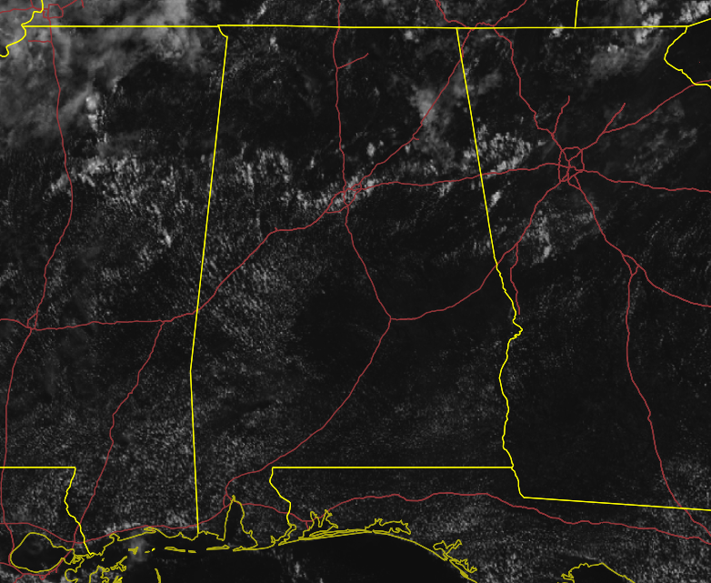
We have mostly clear skies across Central Alabama at this time with a few showers already starting to pop up on radar. Those are over portions of Blount, Walker, and Fayette counties. The rest of the area is dry. Temperatures are in the mid to upper 80s for the most part. Birmingham was at 85 degrees. The cool spot was Gadsden at 83 degrees. Selma was the hot spot at 90 degrees.
Weather for the Rest of Your Wednesday
Scattered showers and thunderstorms are expected to form again later today across all of the area with the highest concentration of those occurring north of a line from Tuscaloosa to Jemison to Roanoke. A few may become strong to briefly severe with gusty winds being the main threat. There also may be some brief minor flooding issues if larger storms stay over the same location for a long duration. Afternoon highs will be in the lower to mid-90s across the area.
Rain and storms will begin to diminish as the sun sets and we should be rain-free by the late-night to overnight hours. Skies will be mostly clear, but we could have some patchy dense fog develop is some locations. Lows will be in the lower to mid-70s.
Much of the Same for Thursday
Nearly a carbon copy of today’s forecast… Hot and humid with a good bit of sunshine early, but clouds will build with the heating of the day and scattered showers and thunderstorms will form for the afternoon and early evening hours. Afternoon highs will be in the lower to mid-90s with heat indices reaching the 100-105 degree range.
About to Have Our First Hurricane in the Atlantic
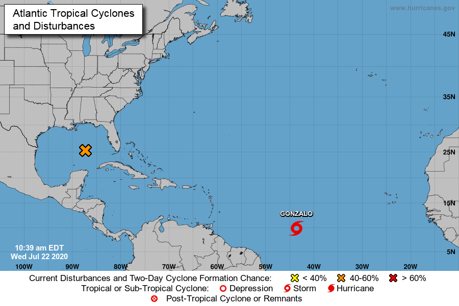
Tropical Storm Gonzalo continues to strengthen as maximum sustained winds are at 50 MPH as it continues to move west across the Atlantic Ocean at 14 MPH. Strengthening is expected to continue throughout the next few days and Gonzalo is expected to become a hurricane at some point on Thursday. Gonzalo looks to weaken back to a tropical storm by Saturday as it approaches the Winward Islands. After that, it is too early to know exactly where the path will take it, but the Gulf of Mexico is a potential target.
Speaking of the Gulf of Mexico… We have a wave moving west-northwestward across the Central Gulf of Mexico that could potentially become a tropical depression over the next couple of days. Hurricane Hunter aircraft has been scheduled to investigate it later today if needed. We’ll have rough surf and dangerous and life-threatening rip currents possible along the Alabama and Western Florida Panhandle Gulf Coast from today through the end of the workweek.



