


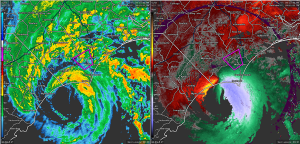
The latest radar image as of 9:12 pm CDT shows that the northernmost part of the eyewall of Hurricane Isaias is moving onshore right at the NC/SC state line between Myrtle Beach and Southport. The northeastern quadrant around the eye has really ramped up with estimated winds on radar at 60-80 MPH with potentially higher gusts.
As of the latest NHC update, Isaias was packing maximum sustained winds at 75 MPH and was moving to the north-northeast at 16 MPH. Official landfall looks to occur within the next 60-120 minutes just to the west of Southport, North Carolina.
The next update will be out at 10:00 pm CDT.



