


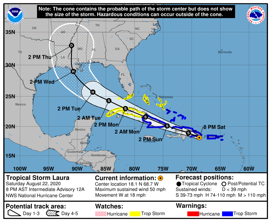
NHC UPDATE SUMMARY OF 7:00 PM CDT INFORMATION
LOCATION…18.1N 68.7W
ABOUT 85 MI…135 KM ESE OF SANTO DOMINGO DOMINICAN REPUBLIC
MAXIMUM SUSTAINED WINDS…50 MPH…85 KM/H
PRESENT MOVEMENT…W OR 280 DEGREES AT 18 MPH…30 KM/H
MINIMUM CENTRAL PRESSURE…1004 MB…29.65 INCHES
WATCHES AND WARNINGS
A Tropical Storm Warning is in effect for…
* Puerto Rico, Vieques, and Culebra
* U.S. Virgin Islands
* The northern coast of the Dominican Republic from Cabo Engano to the border with Haiti
* The southern coast of the Dominican Republic from Cabo Engano to Punta Palenque
* The northern coast of Haiti from Le Mole St. Nicholas to the border with the Dominican Republic
* The southeastern Bahamas and the Turks and Caicos Islands
* Cuban provinces of Camaguey, Las Tunas, Holguin, Guantanamo, Santiago de Cuba, and Granma
A Tropical Storm Watch is in effect for…
* The central Bahamas
* Andros Island
* The Florida Keys from Ocean Reef to Key West and the Dry Tortugas
* Florida Bay
* Cuban provinces of Ciego De Avila, Sancti Spiritus, Villa Clara, Cienfuegos, Matanzas, Mayabeque, La Habana, Artemisa, and Pinar Del Rio
DISCUSSION AND OUTLOOK
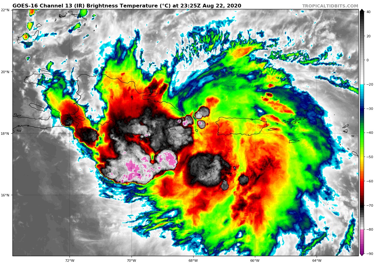
At 800 PM AST (0000 UTC), the center of Tropical Storm Laura was located near latitude 18.1 North, longitude 68.7 West. Laura is moving toward the west near 18 mph (30 km/h), and a generally west-northwestward motion is expected over the next few days. On the forecast track, the center of Laura will move across Hispaniola tonight and early Sunday, near or over Cuba Sunday and Monday, and into the southeastern Gulf of Mexico Monday night and Tuesday.
Maximum sustained winds are near 50 mph (85 km/h) with higher gusts. No significant changes in strength are forecast during the next 48 hours while Laura moves near or over Hispaniola and Cuba. Strengthening is forecast once Laura moves into the Gulf of Mexico Monday night and Tuesday.
Tropical-storm-force winds extend outward up to 205 miles (335 km) from the center.
The estimated minimum central pressure is 1004 MB (29.65 inches).
HAZARDS AFFECTING LAND
RAINFALL: Laura is expected to produce the following rainfall accumulations through Monday:
Puerto Rico and the Virgin Islands: 3 to 6 inches, with maximum amounts of 8 inches possible along eastern portions and the southern slopes.
Dominican Republic and Haiti: 4 to 8 inches, with maximum amounts of 12 inches across southern areas.
Cuba: 3 to 6 inches, with isolated amounts of 8 inches.
This heavy rainfall could lead to life-threatening flash and urban flooding, and the potential for mudslides across the Greater Antilles. Widespread minor to potentially moderate river flooding is possible in Puerto Rico.
1 to 3 inches of rain, with isolated maximum totals of 5 inches, is expected over the northern Leeward Islands, the Turks and Caicos, southeast Bahamas and Jamaica.
WIND: Tropical storm conditions are expected within portions of the warning area through Sunday night. Tropical storm conditions are possible within portions of the watch area on Monday.
SURF: Swells generated by Laura are affecting portions of the northern Leeward Islands, Puerto Rico, and Hispaniola. These swells are expected to spread across Cuba, much of the Bahamas, and the Florida Keys during the next few days. Please consult products from your local weather office.



