


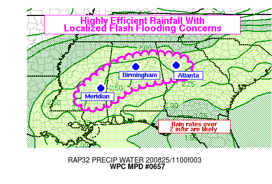
Mesoscale Precipitation Discussion: #0657
Summary…Scattered bands of heavy rain and thunderstorms will move slowly or stall at times through at least midday. Highly efficient and very heavy rainfall may lead to localized flash flooding from east-central Mississippi, through central Alabama, and into northwest Georgia.
Discussion…Regional radars show a broad arc of rain across the Southeast today within a plume of tropical moisture that is still lingering from the now decayed Marco. Although much of this rain was of the steadier, moderate variety, embedded convective bands are producing locally very heavy rainfall. This appears to be a product of the tropical environment, with observed PWATs on the 12Z soundings above 2.2 inches at LIX, BMX, and FFC, and melting levels above 16,000 feet. Combined with relatively weak instability and narrow CAPE profiles, this environment favors highly efficient warm rain processes. Indeed, MRMS shows most of the reflectivity is centered below the melting layer and only small pockets with positive values of vertically integrated ice in the strongest convection. These mesoscale factors are expected to remain aligned for at least the next few hours. Stronger instability does exist in southern Mississippi, and visible satellite shows that some filtered sunshine may allow instability to build through the morning hours. Therefore, deeper convection will be possible further southwest in the outlined region (SW MS, W AL), but the combination of deep tropical moisture and instability should still yield high rain rates even if storm tops build and more ice is present aloft.
Rainfall rates exceeding 2 inches per hour are very likely in this region, and it seems quite possible that stalled convective bands with dominant warm rain processes could produce rain rates in excess of 3 inches per hour in localized areas. This is likely to lead to flash flooding issues across the Southeast. Of particular concern in the immediate future (through 15Z or 16Z) is the area near and just south of the Atlanta Metro Area, where propagation of convective bands is extremely slow or nearly stalled on the latest KFFC radar imagery.



