


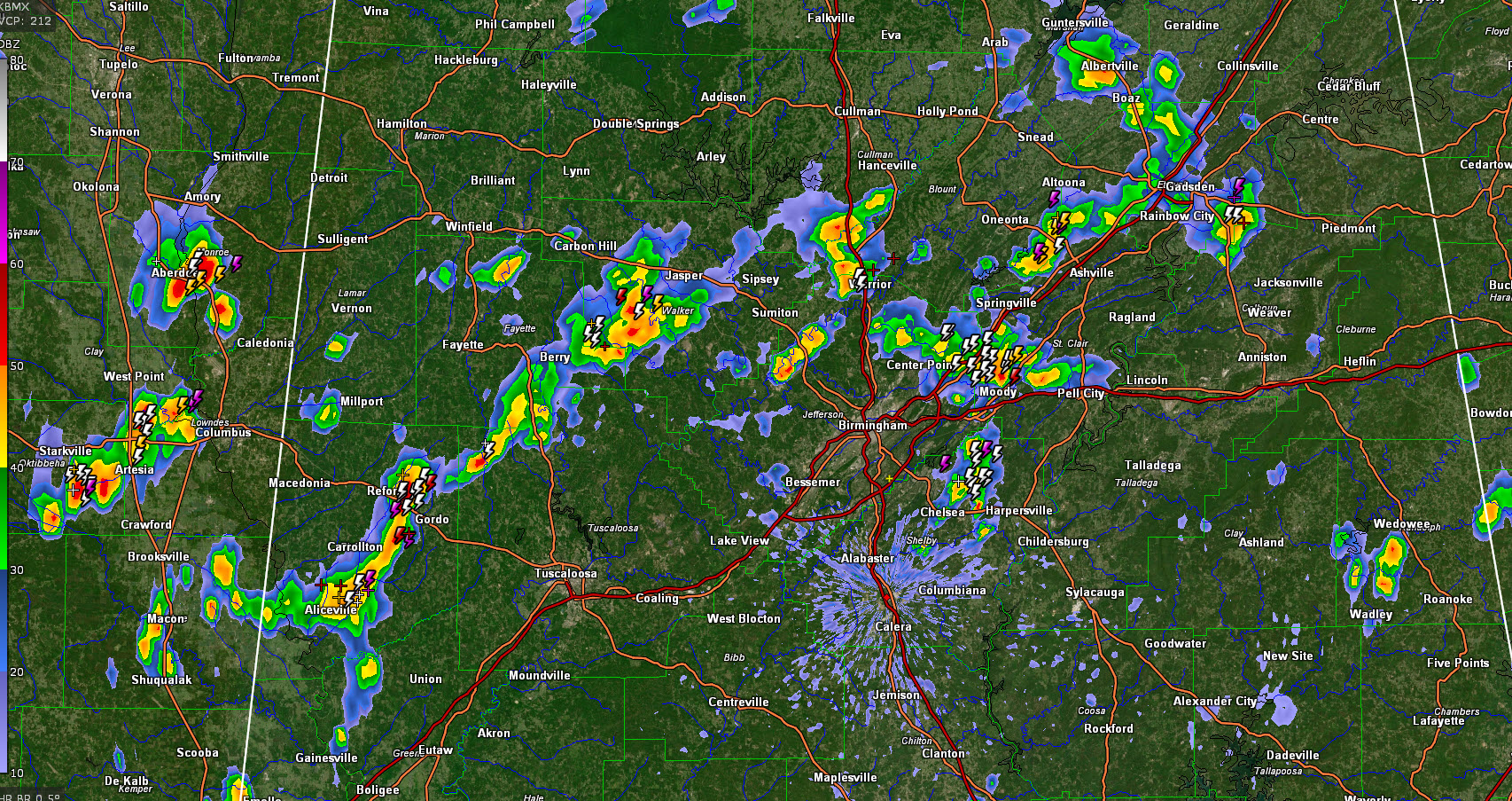
It is a hot and humid last Sunday afternoon of August across Central and North Alabama. Temperatures are warming through the upper 80s and lower 90s.
With all that heat and humidity, instability values are high, with CAPE readings in the 3,000-4,000 joules/kg range.
While moisture is high in the lower levels of the atmosphere, drier air has moved in aloft, and this enhances the possibility of damaging winds with any storms that do get going.
Wind shear is nearly non-existent, as one would expect in late August, so the storm will be of the pulse variety, going up quickly, and coming down just as quickly with that family rush of the downdraft. While it can be a refreshing blast of nature’s air conditioning, it can also bring down trees.
Scattered showers and storms are developing across northern and Central Mississippi and Alabama this afternoon. In Alabama, the main band is just north of I-59. All activity is moving east at 15-20 mph.
The SPC has the northern half of Alabama outlooked for a marginal risk of severe weather (1/5) for today and tonight. Stronger storms will produce wind gusts of 40-60 mph. They just issued a mesoscale discussion for the area, but indicate they will likely not issue a severe thunderstorm watch.
But keep an eye to the sky, and another on the radar won’t hurt.



