


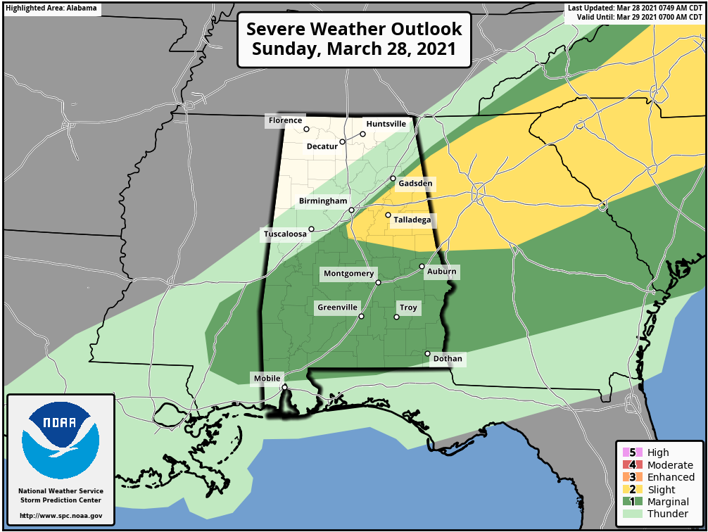
The latest update from the Storm Prediction Center is out and there has been an increase in area to the Slight Risk for severe storms (level 2 of 5). The Slight Risk now includes locations inside a line from Cedar Bluff to Pelham to Montevallo to Dadeville to Valley.
The rest of Central Alabama roughly south of the I-59 corridor remains in a Marginal Risk for severe storms (level 1 of 5) for several more hours.
For locations in North/Central Alabama north and west of I-59, the threat of severe weather has come to an end.
Here is the latest Day 1 Severe Weather Outlook from the SPC:
A semi-broken/quasi-linear cluster of storms may continue to pose an isolated severe risk this morning from central/eastern Alabama into western/northern Georgia and western South Carolina. These storms may tend to outpace the more appreciable moistening/destabilization from the southwest, while low-level winds will otherwise continue to veer over time. Isolated wind damage will remain possible early today, and potentially remain possible this afternoon into other parts of Georgia/South Carolina pending downstream destabilization and the disposition of the early day convective line.



