


Update at 648 pm
The storm in Tuscaloosa County has weakened and is no longer severe. Heavy rain, lightning, gusty winds, and some small hail will accompany it as it moves into southeastern Fayette County near Berry.
No warnings in effect for any part of Alabama now.
ORIGINAL POST
Very large hail is indicated along the Tuscaloosa/Pickens County line southwest of Moore’s Bridge.
There is a threat of damaging winds as well.
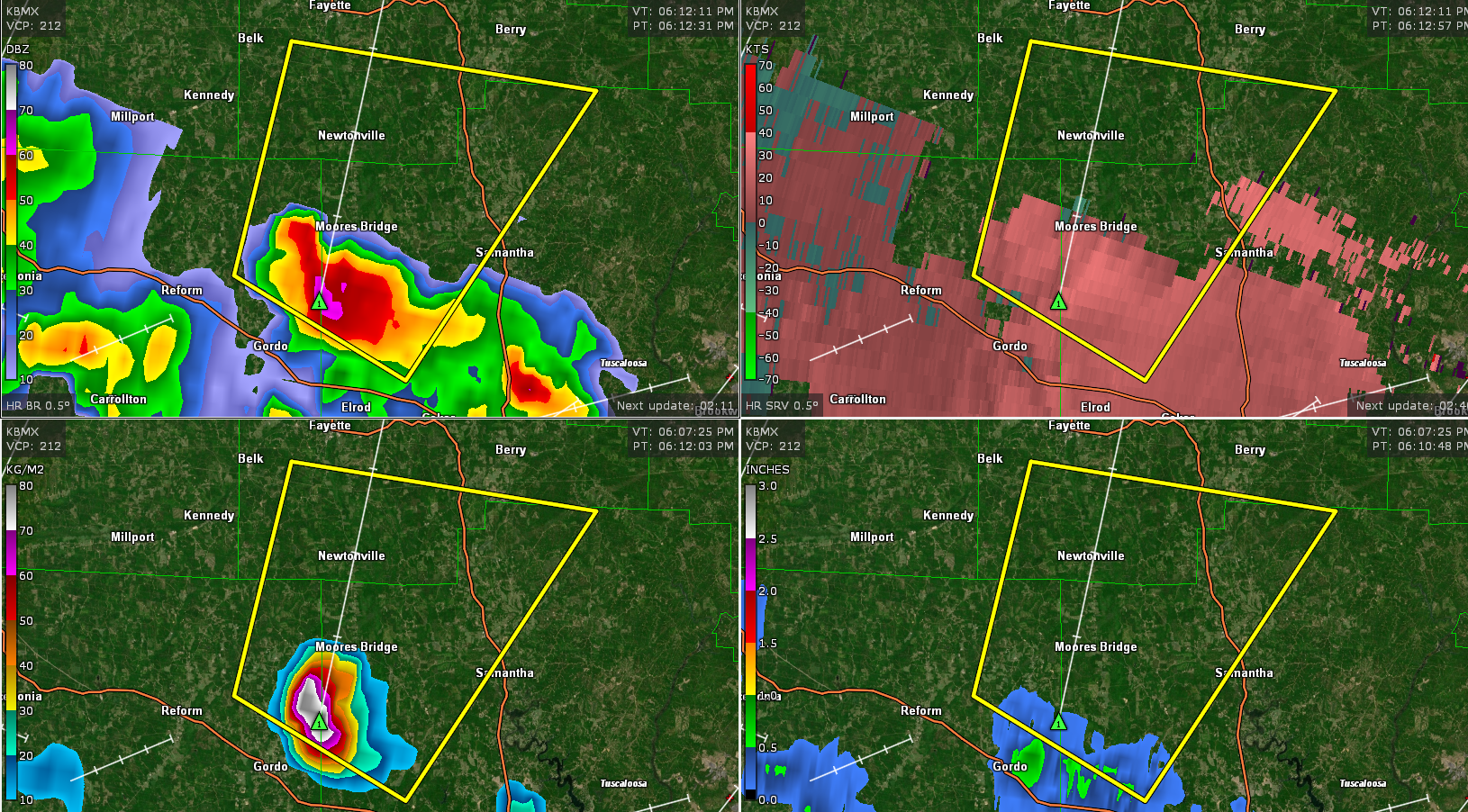
The National Weather Service in Birmingham has issued a
* Severe Thunderstorm Warning for…
Northwestern Tuscaloosa County in west central Alabama…
Northeastern Pickens County in west central Alabama…
Southwestern Fayette County in west central Alabama…
* Until 700 PM CDT.
* At 611 PM CDT, a severe thunderstorm was located near Gordo, moving
northeast at 20 mph.
HAZARD…Golf ball size hail and 60 mph wind gusts.
SOURCE…Radar indicated.
IMPACT…People and animals outdoors will be injured. Expect hail
damage to roofs, siding, windows, and vehicles. Expect
wind damage to roofs, siding, and trees.
* Locations impacted include…
Ashcraft Corner, Echola, Lubbub, Stone Wall, Moores Bridge and New
Lexington.



