


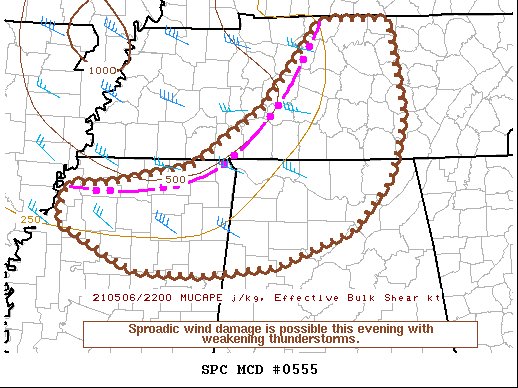
SUMMARY… Sporadic wind damage will be possible this evening with a weakening line of thunderstorms.
DISCUSSION… At 5 pm (22Z), an arcing line of low-topped thunderstorms is approaching portions of northern MS/AL into middle TN, in conjunction with a compact midlevel vorticity maximum moving southeastward into portions of the OH/TN valleys. Wind gusts of 40-45 kt have been noted with the line across western TN within the last hour. While buoyancy is weak across the region (MUCAPE generally 500 J/kg or less), steep low-level lapse rates within a dry, well-mixed boundary layer continue to support the potential for stronger wind gusts capable of producing at least isolated wind damage.
The already weak instability will diminish even further this evening, with the onset of nocturnal cooling/boundary-layer stabilization. However, given the relative strength of the midlevel system and surface cold pool, some threat for sporadic damaging wind gusts will continue for a while this evening as convection gradually weakens. At this time, the remaining threat appears too limited in duration and magnitude for additional watch issuance.



