


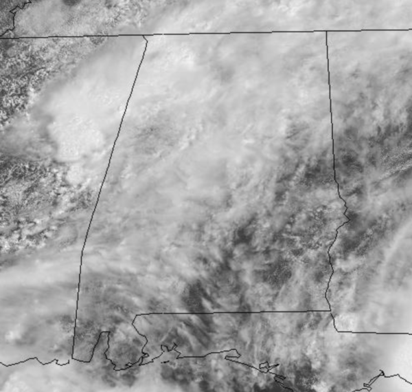
High moisture levels and a nearby upper trough means widespread to numerous showers and storms will remain in the forecast today and tomorrow. With the clouds and rain, temperatures will range from the upper 70s to lower 80s both days, which are well-below average for July in Alabama. By Friday, rain chances should decrease a bit, but we will continue to mention scattered showers and storms in the forecast; highs should return to the mid and upper 80s.
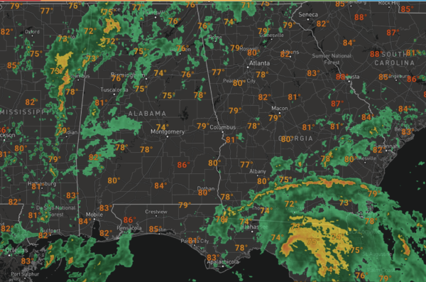
RADAR CHECK: At 11AM, widespread showers were ongoing across North and Central Alabama and these will continue to expand in coverage as we head into the afternoon hours and it looks to be rather wet for many locations through the rest of today. Some storms will begin to develop as well and we can expect a lot of lightning and very heavy rainfall in some of the stronger storms; also, some gusty winds are possible. We also can see all the rain associated with Elsa across South Georgia and North Florida.
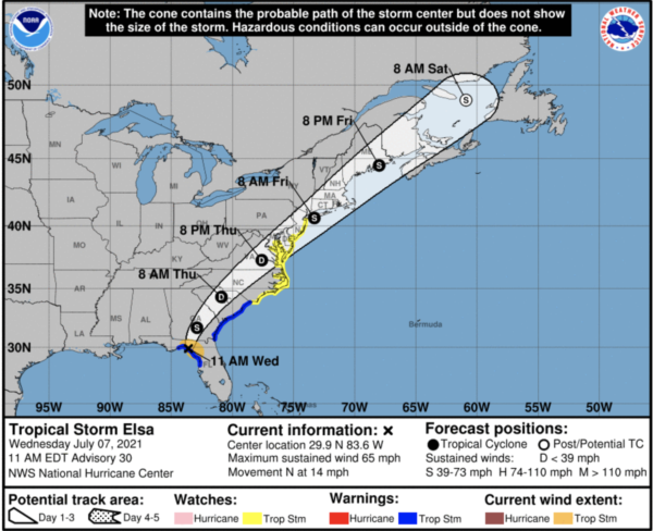
ELSA MAKES LANDFALL: This morning in Taylor County, Florida as the center of Tropical Storm Elsa was located ear latitude 29.9 North, longitude 83.6 West. Elsa is moving toward the north near 14 mph, and a generally northward motion is expected to continue through this afternoon. A turn toward the north-northeast is expected late this afternoon or tonight, followed by a faster northeastward motion by late Thursday. On the forecast track, Elsa will continue to move inland into Florida this afternoon. The storm should then move across the southeastern and mid-Atlantic United States through Thursday.
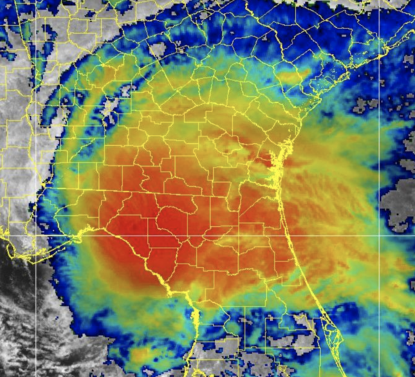
Maximum sustained winds are near 65 mph with higher gusts. Weakening is expected as Elsa moves further inland this afternoon into tomorrow. Tropical-storm-force winds extend outward up to 90 miles from the center. An unofficial weather station at Horseshoe Beach, Florida recently measured a sustained wind of 62 mph gusting to 71 mph. Earlier, a C-MAN station at Cedar Key, Florida measured a sustained wind of 44 mph gusting to 59 mph. The estimated minimum central pressure is 999 mb (29.50 inches).
Though Elsa will remain east of Alabama, and we expect little to no impacts from the system, we will mention rip currents to be an issue along the Northern Gulf Coast today and the next couple of days. Be mindful of that and pay attention to the flag warning system along the Gulf Coast Beaches.
BEACH FORECAST CENTER: Get the latest weather and rip current forecasts for the beaches from Fort Morgan to Panama City on our Beach Forecast Center page. There, you can select the forecast of the region that you are interested in visiting.
WORLD TEMPERATURE EXTREMES: Over the last 24 hours, the highest observation outside the U.S. was 121.3F at Jahra, Kuwait. The lowest observation was -94.2F at Dome C, Antarctica.
CONTIGUOUS TEMPERATURE EXTREMES: Over the last 24 hours, the highest observation was 124F at Death Valley, CA. The lowest observation was 31F at Peter Sinks, UT.
WEATHER ON THIS DATE IN 1981: Montana was in the midst of a snowstorm that dumped ten inches at Glacier National Park, and produced winds to 90 mph. Meanwhile, Denver, CO, set a record high with a reading of 101 degrees.



