


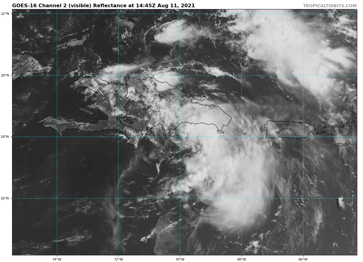
SUMMARY OF 10:00 AM CDT INFORMATION:
LOCATION…18.2N 69.7W
ABOUT 25 MI…40 KM SSE OF SANTO DOMINGO DOMINICAN REPUBLIC
ABOUT 245 MI…395 KM SSE OF GRAND TURK ISLAND
MAXIMUM SUSTAINED WINDS…45 MPH…75 KM/H
PRESENT MOVEMENT…WNW OR 290 DEGREES AT 16 MPH…26 KM/H
MINIMUM CENTRAL PRESSURE…1006 MB…29.71 INCHES
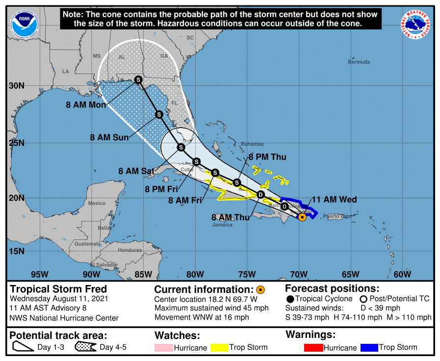
WATCHES & WARNINGS
A Tropical Storm Warning is in effect for…
* Dominican Republic on the south coast from Punta Palenque eastward and on the north coast from the Dominican Republic/Haiti border eastward
A Tropical Storm Watch is in effect for…
* Haiti from the northern border with the Dominican Republic to Gonaives
* Turks and Caicos Islands
* Southeastern Bahamas
* The Cuban provinces of Ciego de Avila, Camaguey, Las Tunas, Holguin, Granma, Santiago de Cuba, and Guantanamo
FORECAST DISCUSSION:
Morning satellite imagery and reports from a NOAA Hurricane Hunter aircraft indicate that the circulation of Fred has become better defined south of the eastern Dominican Republic. The NOAA plane reported maximum flight-level winds of 40-45 kt, and SFMR winds of up to 50 kt, although these were measured near the coast and the reliability is unknown. The central pressure is near 1006 mb. Based on these data and a dropsonde northeast of the center, the initial intensity is increased to 40 kt. The low-level center is partly exposed near the western edge of the convection, which has decreased in coverage since yesterday.
The center has been moving more westward for the past few hours. However, the longer term motion is 290/14. There is no change in the track forecast philosophy since the previous advisory. Fred should continue moving generally west-northwestward for the next 72 hours or so, followed by a turn toward the northwest as the cyclone nears the western periphery of the ridge. The new forecast track is little changed from the previous advisory and lies near the various consensus models. However, some adjustments to the track may be necessary as the center interacts with the mountains of Hispaniola during the next 12-24 hours.
Fred is now in an environment of 15-20 kt of westerly vertical shear produced in part by an upper-level trough near the Florida Peninsula, and the global models suggests that moderate shear should persist for at least the next 48-60 hours. This, combined with land interaction, should cause Fred to weaken as it crosses Hispaniola, and then at best slowly re-intensify after it emerges over the water. After that time, the global models suggest the trough should weaken as a large upper-level anticyclone forms near or just southeast of Fred. This evolution could let the shear decrease a little and allow a little more strengthening, particularly when Fred is over the Gulf of Mexico. The new intensity forecast is similar to the previous forecast and follows the overall trend of the intensity guidance.
KEY MESSAGES:
1. Tropical storm conditions are spreading across portions of the Dominican Republic. Tropical storm conditions are possible in northern Haiti and the southeastern Bahamas by late today, and in portions of Cuba by tonight.
2. Heavy rainfall could lead to flash, urban, and small stream flooding, along with possible rapid river rises and the potential for mudslides in the Dominican Republic. Heavy rainfall could lead to flash, urban, and small stream flooding, along with possible rapid river rises across southern Florida.
3. There is a risk of wind and rainfall impacts elsewhere in portions of Hispaniola, the Bahamas, and Cuba during the next few days, although the forecast is more uncertain than usual since Fred is forecast to interact with Hispaniola today and tonight. Interests in these areas should monitor Fred’s progress and updates to the forecast.
4. There is an increasing risk of wind and rainfall impacts in Florida beginning Friday night or early Saturday in the Keys and spreading northward through portions of the Peninsula and the Panhandle Saturday through Monday. Interests throughout Florida should monitor Fred’s progress and check updates to the forecast.



