


Alabama’s weather, and the weather of the coast to our south, is highly dependent on the fate and track of what used to be Tropical Storm Fred.
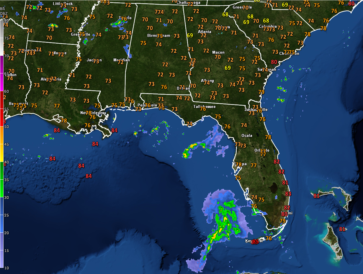
SORTING OUT FRED’S FUTURE: As of the deadline for this forecast package Saturday night, it was still a disorganized mess. But it has reacquired a broad circulation. The system has plenty of warm water to work with though, but is dealing with a bit of vertical shear. That shear is expected to relax this afternoon and tonight. This may allow the system to reacquire tropical storm strength soon. The shear increases again a bit before landfall, so the system is not expected to rapidly intensify or go crazy. The official forecast takes it to a max intensity of 50 mph before landfall. That landfall should come Monday night, right after midnight, most likely on the western Florida Panhandle near Pensacola or Fort Walton.
GULF COAST IMPACTS: Showers and storms will be likely along the beautiful beaches of Alabama and Northwest Florida starting today. By afternoon, they will actually be associated with the first of the outer bands of what should be Tropical Storm Fred. Expect a couple of feeder bands tonight and early Monday before the main activity arrives around noon tomorrow. A breezy easterly wind will kick in tonight, averaging 15 mph. By tomorrow, it will be picking out, averaging 20 mph and beginning to gust to 35 mph at times. Those winds will continue picking up through the afternoon, averaging 35 mph with gusts to 50 mph. Surf will increase to 4 feet tonight, 6 feet tomorrow, and 7 feet before the storm’s center arrives. The rip current risk will become high starting tonight and continuing through Tuesday night. There will be a threat of waterspouts and tornadoes starting late tonight, and continuing into Monday.
OF COURSE: All of this is based on the forecast that brings Fred back to tropical storm strength. If that doesn’t happen, the forecast will be different. The eventual track will determine where the worst impacts will be, but they will be felt across a wide area of the Gulf Coast.
FOR US HERE: Today will feature more in the way of showers and storms than the past couple of days as moisture levels rise, and we begin to feel both the effects of a trough of low pressure to the north and convergence on the northern side of the tropical system. Highs this afternoon will be in the upper 80s, with a few readings pushing 90F in the US-80 Corridor.
MONDAY/TUESDAY: Clouds will be on the increase on Monday, with periods of showers and thunderstorms becoming. Highs will be in the upper 80s. Rain and storms will remain in the forecast, with some heavier showers and storms spreading northward overnight. Winds will become gusty at times, out of the east at 15-20 mph at times. Tuesday will feature wind and rain, with winds gusting to near tropical storm force at times, along with heavy rain and tornadoes. The center of the weakening system should reach the I-20 corridor by mid-evening Tuesday night and pass out of North Alabama during the overnight hours. Wind and rain will diminish in its wake.
WEDNESDAY-FRIDAY: A warm and moist air mass will be left in place in the wake of Fred, giving us scattered to numerous showers and storms each day. Highs will be in the upper 80s. Lows will be in the lower 70s.
WEEKEND OUTLOOK: Showers and storms look like they will begin to make themselves more scarce by Saturday and Sunday. The mercury will feel this, pushing back toward 90F for highs.
GRACE: Of course, all that could be out the window if Grace becomes our problem. The minimal tropical storm made it into the northeastern Caribbean overnight, but it remained disorganized as a result of its fast forward speed. There were signs that the forward motion was slowing by late last night, however, and the system could strengthen some today before it encounters the island of Hispaniola tomorrow. It will take a day to cross, and then it will begin traveling along the Cuban coast, popping out into the Gulf of Mexico by Wednesday or Thursday. It should be really disorganized but could build up steam again over the Gulf. By Thursday, it is forecast to be somewhere in the center of the Gulf of Mexico. It poses a potential threat to the area from Texas to Northwest Florida.
BEACHCAST: Showers and thunderstorms will be increasing through tomorrow along the beautiful beaches of Alabama and Northwest Florida. Winds will be on the increase as well, along with surf and rip currents. The main wind and rain will come Monday and Monday night, with improving conditions Tuesday.
Click here to see the Beach Forecast Center page.
DANCING WITH THE STATS: The 90F reading at South Lake Tahoe yesterday tied the record for the date. Several western stations tied or broke their records, as well, as the region, continues to bake under a major heatwave.
ADVERTISE WITH US: Deliver your message to a highly engaged audience by advertising on the AlabamaWX.com website. The site has enjoyed over 29 MILLION page views in the past 12 months. Don’t miss out! We can customize a creative, flexible, and affordable package that will suit your organization’s needs. Contact me, Bill Murray, at (205) 687-0782, and let’s talk.
WEATHERBRAINS: This week, the panel will entertain storm chaser Parker Koppes, who has an amazing life story. Check out the show at www.WeatherBrains.com. You can also subscribe on iTunes. You can watch the show live at live.bigbrainsmedia.com or on James’ YouTube Channel You will be able to see the show on the James Spann 24×7 weather channel on cable or directly over the air on the dot 2 feed.
ON THIS DATE IN 1969: Hurricane Camille became a hurricane south of Cuba and entered the Gulf of Mexico with winds of 115 mph. Follow my weather history tweets on Twitter. I am @wxhistorian at Twitter.com.



