


LATE REPORT
At 9:20 a.m. CDT this morning, Tyndall AFB Tower reported a wind gust of 56 mph.
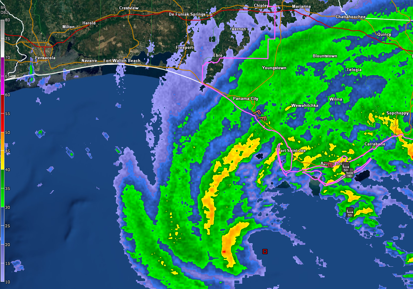
Winds are starting to increase along the Gulf Coast as the center of Tropical Storm Fred approaches.
Coastal radars indicate that the surface center is located about 50 miles south-southwest of Port St. Joe. The motion is north northeast at 10 mph.
There is a burst of convection that has initiated around the center. We could see additional strengthening in this last 4-5 hours before landfall, which will likely occur around Mexico Beach.
Some coastal reports at 10:30:
Apalachicola (Tide Site)…E 22 G 31…Pressure 1011 mb
Apalachicola Airport…E 18 G 32…Pressure 1009 mb…Light Rain
Tallahassee…E 21 Rain…Pressure 1015 mb
Tyndall…ENE 17 G 28…Pressure 1010 mb…Light Rain
Panama City Tide Site…NE 12 G 20…Pressure 1012 mb
Destin…NE 8 G 17…Pressure 1013…Light Rain
At 10:20 a.m., a WeatherSTEM station near Eastpoint reported a gust to 54 mph.



