


SUMMARY OF 1100 AM AST…1500 UTC…INFORMATION
———————————————–
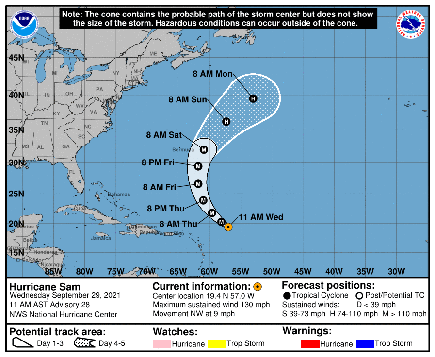
LOCATION…19.4N 57.0W
ABOUT 405 MI…655 KM ENE OF THE NORTHERN LEEWARD ISLANDS
MAXIMUM SUSTAINED WINDS…130 MPH…215 KM/H
PRESENT MOVEMENT…NW OR 310 DEGREES AT 9 MPH…15 KM/H
MINIMUM CENTRAL PRESSURE…949 MB…28.03 INCHES
WATCHES AND WARNINGS
——————–
There are no coastal watches or warnings in effect.
DISCUSSION AND OUTLOOK
———————-
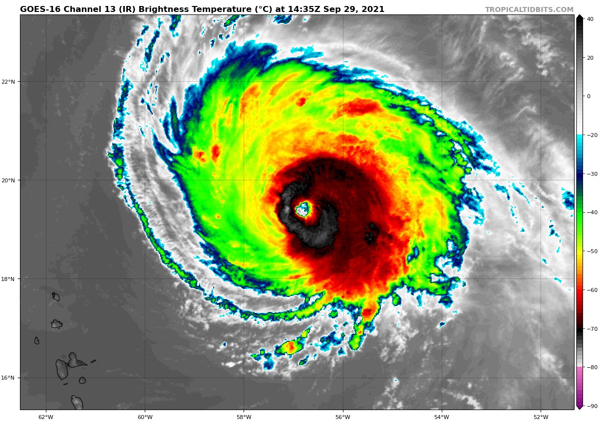
At 1100 AM AST (1500 UTC), the center of Hurricane Sam was located near latitude 19.4 North, longitude 57.0 West. Sam is moving toward the northwest near 9 mph (15 km/h), and this general motion with an increase in forward speed is expected during the next couple of days. A turn toward the north is forecast by Friday. On the forecast track, Sam will pass well to the east-northeast of the northern Leeward Islands through tonight.
Maximum sustained winds are near 130 mph (215 km/h) with higher gusts. Sam is a category 4 hurricane on the Saffir-Simpson Hurricane Wind Scale. Some fluctuations in intensity are expected during the next couple of days, but Sam is forecast to remain a major hurricane through late this week.
Hurricane-force winds extend outward up to 40 miles (65 km) from the center, and tropical-storm-force winds extend outward up to 125 miles (205 km). The minimum central pressure estimated from NOAA Hurricane Hunter aircraft observations is 949 mb (28.03 inches).
HAZARDS AFFECTING LAND
———————-
SURF: Swells generated by Sam will impact the Lesser Antilles during the next several days. Swells are expected to reach Bermuda and the Bahamas in a day or so, and then spread to the United States east coast by this weekend. These swells could cause life-threatening surf and rip current conditions. Please consult products from your local weather office.



