


It was another cold morning, but as we roll into the afternoon, the dry air in place is warming up nicely with most North/Central Alabama locations in the low to mid 70s, under a sky full of sunshine.
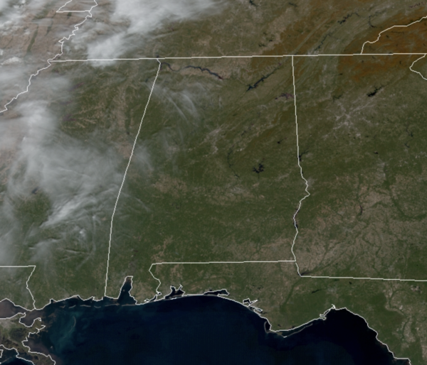
Not much change in the forecast for tomorrow, as temperatures will return to the 70s, but we do note clouds will be on the increase, especially as we head into tomorrow night.
RAIN RETURNS: The clouds are ahead of a cold front that will bring rain and a few rumbles of thunder back to Alabama during the day Thursday. Severe storms are not expected with the main dynamic support passing well to the north and the main window for rain will come from 6AM-6PM as the timing of the front will be a little quicker than first thought. Rain amounts of around 1/2 inch are expected and Thursday’s high will be in the low 70s for most places.
FRIDAY AND THE WEEKEND: The front will be pushing out of the state early Friday morning and the sky becomes mostly sunny Friday with a brisk north wind. It will be cooler as highs will be in the 60-65 degree range. The weekend will be dry and colder with morning lows in the low and mid 30s, while we expect a sunny sky Saturday with highs in the 50s. Sunday will feature a few more clouds by the afternoon with highs in the upper 50s to low 60s.
BEACH FORECAST CENTER: Get the latest weather and rip current forecasts for the beaches from Fort Morgan to Panama City on our Beach Forecast Center page. There, you can select the forecast of the region that you are interested in visiting.
WORLD TEMPERATURE EXTREMES: Over the last 24 hours, the highest observation outside the U.S. was 112.3F at Tete, Mozambique. The lowest observation was -67.0F at Vostok, Antarctica.
CONTIGUOUS TEMPERATURE EXTREMES: Over the last 24 hours, the highest observation was 91F at Coolidge, AZ. The lowest observation was 0F at Mackay, ID.
WEATHER ON THIS DATE IN 1913: The freshwater fury, a rapidly deepening cyclone, caused unpredicted gales on the Great Lakes. Eight large ore carriers on Lake Erie sank drowning 270 sailors. Cleveland OH reported 17.4 inches of snow in 24 hours, and a total of 22.2 inches, both all-time records for that location. During the storm, winds at Cleveland averaged 50 mph, with gusts to 79 mph. The storm produced wind gusts to 80 mph at Buffalo NY, and buried Pickens WV under three feet of snow.



