


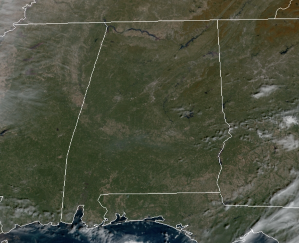
As we roll into the afternoon, temperatures are warming up nicely again with most locations in the low to mid to 70s. It remains mainly sunny, but clouds will begin to increase and will continue to do so as we head into the overnight hours. Not as cold tonight as lows will hold in the mid 50s across North/Central Alabama.
COLD FRONT ON THE WAY: The cold front will move into Alabama tomorrow and will bring rain and a few rumbles of thunder back to Alabama at times. Severe storms are not expected with the main dynamic support passing well to the north and the main window for rain will come from 6AM-6PM. Rain amounts should be less than 1/4 inch and the rain will end tomorrow evening for most communities.
FRIDAY AND THE WEEKEND: Friday will be mostly sunny and cooler with highs in the 60-65 degree range. Much colder air drops into Alabama late Friday night and Saturday and Sunday will feature highs in the 50s despite a sky full of sunshine. Expect frosty mornings as low fall into the upper 20s and lower 30s.
FRIDAY NIGHT LIGHTS: For the high school playoff games Friday night, the sky will be clear with temperatures mostly in the 40s.
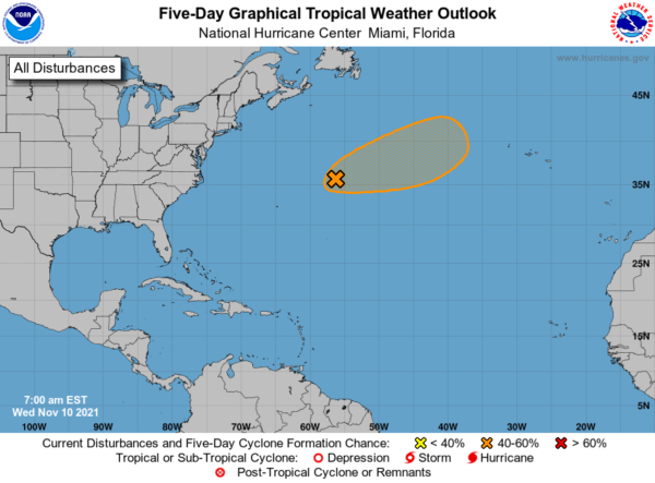
IN THE TROPICS: Showers and thunderstorms have decreased near the center of a hurricane-force non-tropical low pressure system located a little over 500 miles east-northeast of Bermuda. While a large area of shower activity associated with a frontal boundary persists to the northeast of the low’s center, the system has not yet acquired sufficient characteristics to be classified as a subtropical cyclone. However, some additional development is still possible during the next day or two while upper-level winds become a little more favorable, and a subtropical storm could form during this time. Thereafter, the system is forecast to move over colder water and be absorbed by a larger non-tropical low. Formation chance through 48 hours…medium…50 percent.
BEACH FORECAST CENTER: Get the latest weather and rip current forecasts for the beaches from Fort Morgan to Panama City on our Beach Forecast Center page. There, you can select the forecast of the region that you are interested in visiting.
WORLD TEMPERATURE EXTREMES: Over the last 24 hours, the highest observation outside the U.S. was 113.9F at Tete, Mozambique. The lowest observation was -68.6F at Vostok, Antarctica.
CONTIGUOUS TEMPERATURE EXTREMES: Over the last 24 hours, the highest observation was 89F at El Centro Naval Air Facility, CA. The lowest observation was 12F at Rapid River, MI.
WEATHER ON THIS DATE IN 1915: An unusually late season tornado struck the central Kansas town of Great Bend killing eleven persons along its 35 mile track. The tornado destroyed 160 homes in Great Bend killing 11 persons and causing a million dollars damage. Hundreds of dead ducks dropped from the sky northeast of the track’s end.



