


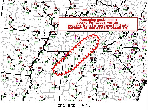
We continue to have a threat of strong to severe thunderstorms for the next several hours across North/Central Alabama, with the main threat coming from damaging wind gusts, but a couple of tornadoes still cannot be ruled out at this point.
Here is the text from the latest Mesoscale Discussion from the SPC:
SUMMARY… Damaging wind gusts and a couple of tornadoes remain possible this morning.
DISCUSSION… Convection has solidified into a mature QLCS from eastern portions of Middle TN into northwest AL and far northeast MS this morning. Surface dewpoints range from the mid/upper 60s across southern portions of the MCD area to near 60 F across northern portions of WW 562. This is contributing to around 250-750 J/kg MLCAPE. While instability is weak, deep-layer flow remains quite strong, supporting the organized line of convection. Low-level flow has become more veered with time, as is evident in both surface observations at the progression of VWP data from KHTX. In conjunction with limited instability, this is precluding stronger low-level rotation. Nevertheless, severe instances of weakly rotating cells/mesovortices have been noted over the past 1-2 hours in regional radar data. A threat for damaging wind gusts and a couple of tornadoes will remain possible across the remainder of WW 562 the next few hours.



