


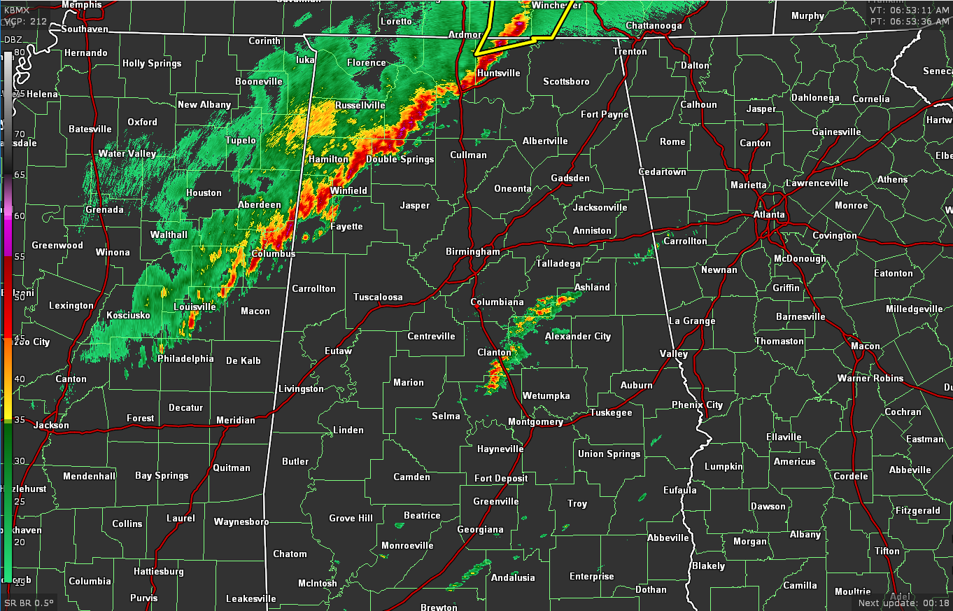
As of 6:55 am, the line of storms was stretching across portions of North/Central Alabama from Hazel Green in Madison County, down through Haleyville in Winston County, and exiting back into Mississippi after passing through Vernon in Lamar County. As of now, only a small sliver of the northern parts of Madison County remain in a severe thunderstorm warning until 7:15 am. The rest of North/Central Alabama is warning-free.
So far, we have had only a few reports of damage, but it has been nothing like places that were hit by tornadoes stretching from Arkansas to Kentucky. Unfortunately, it looks like at least 50 deaths have been reported in Kentucky as a candle factory was leveled. There is a possibility that one of the tornadoes may have been on the ground for over 250 miles, but we’ll have to wait and get confirmation from the National Weather Service. Here is the latest damage reports in to NWS Chat:
Local Storm Report by NWS HUN: 2 SSW Florence [Lauderdale Co, AL] emergency mngr reports TSTM WND GST of M59 MPH at 05:33 AM CST — emergency manager measured a 59 mph wind gust in downtown florence, al.
Local Storm Report by NWS HUN: Sheffield [Colbert Co, AL] emergency mngr reports TSTM WND DMG at 05:34 AM CST — tree down. nwsbot @ 6:52
Local Storm Report by NWS HUN: 1 SW Tuscumbia [Colbert Co, AL] emergency mngr reports TSTM WND DMG at 05:36 AM CST — tree down.
Some good news to report… the Tornado Watch has been canceled for Colbert, Franklin, and Lauderdale counties in North Alabama. The watch continues until 11 am for Cullman, DeKalb, Jackson, Lawrence, Limestone, Madison, Marshall, Morgan counties in North Alabama, and for Fayette, Lamar, Marion, Walker, Winston counties in Central Alabama.

The Storm Prediction Center has trimmed the Slight Risk down, removing the far northwestern parts of the area, as the severe weather threat has now ended for those locations. The Slight Risk now includes locations along and south of a line from Athens (Limestone Co.) to Sulligent (Lamar Co.) and stretches southward to cover much of the rest of Central Alabama. A Marginal Risk is up for locations south of a line from Minter (Dallas Co.) to Sprague (Montgomery Co.) to Smiths Station (Lee Co.).
This has become more of a damaging wind threat at the moment, but a few brief spin-up tornadoes cannot be ruled out. If you are still out in front of this line of storms, you will need to stay weather aware until the line passes your location.



