


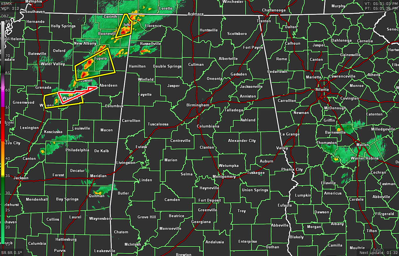
We have a line of storms that is moving into the northwest corner of the state, with the potential for gusty winds up to 40 mph that could potentially knock down tree limbs and blow around unsecured objects. A few cells along the line have severe thunderstorm warnings on them, with one being tornado warned for a radar-indicated rotation couplet. That cell is moving to the northeast at 40 mph. The rest of North/Central Alabama is quiet at this point.
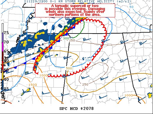
We have a risk of tornadic supercells over the northwestern parts of the area from now through the rest of the evening. Damaging winds are also expected over the same locations. Here is the latest from the SPC:
SUMMARY… Conditions will remain most favorable for tornadoes over the next several hours from northeast Mississippi into northern Alabama and southern Middle Tennessee.
DISCUSSION… A cold front currently extends from Middle TN across northern MS and into southeast AR, enhanced by outflow. Recently, a line of cells has developed from TN into northern MS, with the orientation of these cells removed from the cold front.
Areas of rotation have been noted with cells both along the cold front near the TN/MS border, and farther southwest. Given the deep-layer shear vector orientation, and strong 60 kt magnitudes, it is anticipated that a few of these cells may remain enough ahead of the cold front to become tornadic supercells, whereas farther north into TN, a QLCS is most likely.
Strong west/southwest 850 mb flow will continue to advect theta-e northeastward ahead of these cells. 0-1 SRH of 200-300 m2/s2 exists per objective analysis, maximized near the old outflow boundary. Therefore, a tornadic supercell or two appears possible as cells mature within the high-shear environment. In addition, damaging winds will be likely with solid portions of the line, and additional counties may need watch consideration later this evening downstream into eastern TN and northern GA.



