WARM: For many Alabama communities, today is the warmest day so far this year as temperatures are in the low 80s at mid-afternoon with a sunny sky. The average high for Birmingham on March 4 is 64. Tonight will be mostly clear with a low in the 48-54 degree range.
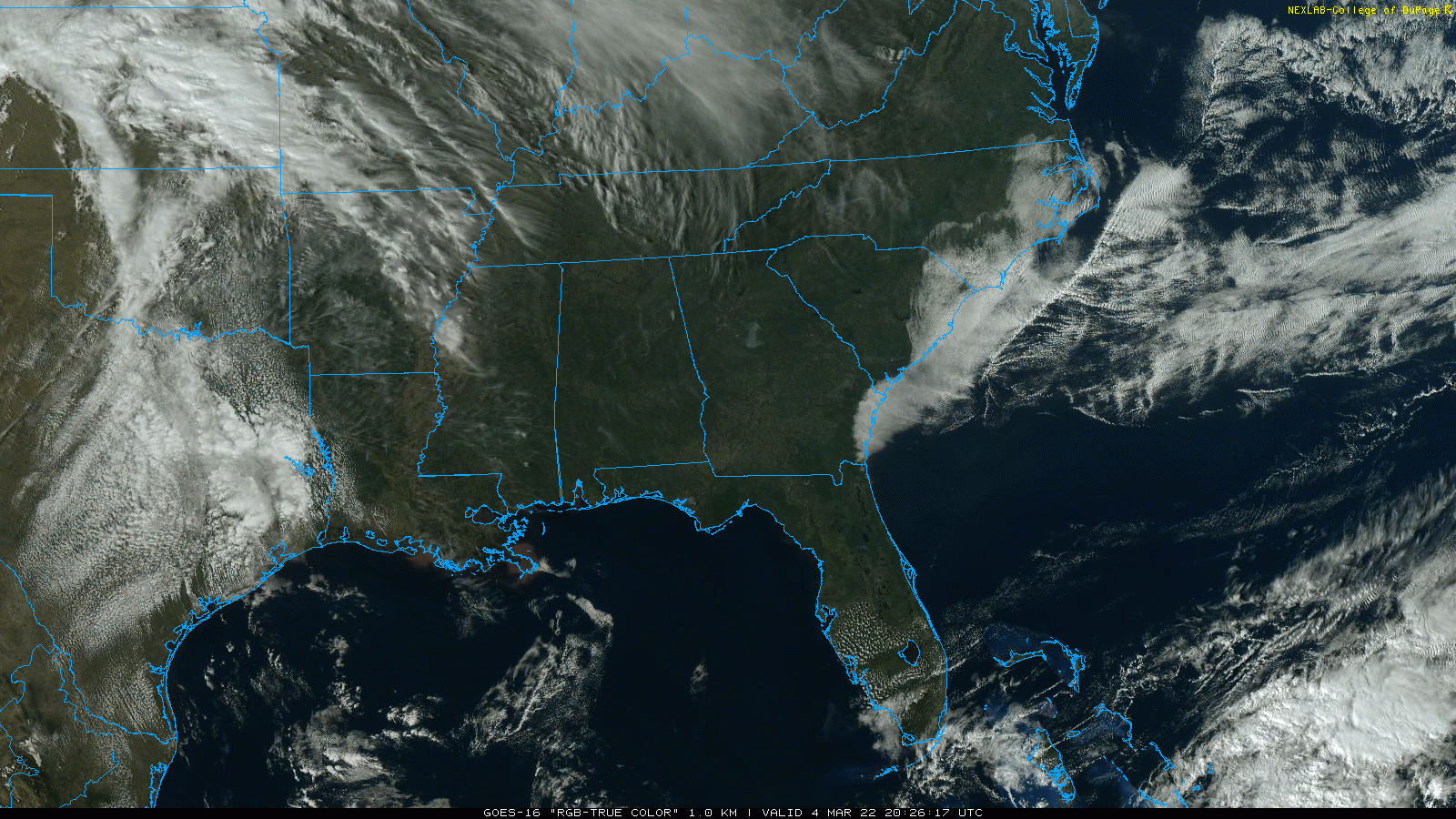
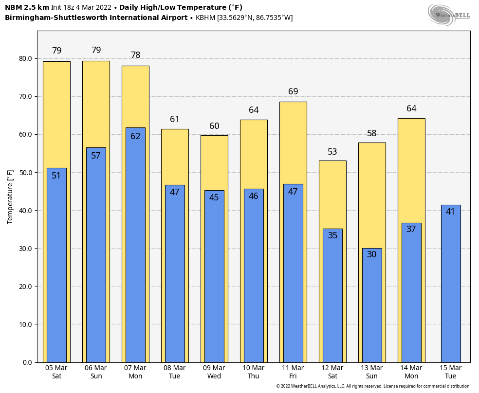
Warm, dry weather continues over the weekend. Expect a partly sunny sky tomorrow and Sunday with highs holding in the low 80s in most places. It will be the warmest weekend so far this year.
MONDAY: A cold front will push into the state, bringing showers and storms by afternoon. Some of the storms could be strong to severe; SPC has much of North and Central Alabama in a severe weather risk in their “Day 4” outlook for Monday. The risk is defined for areas north of a line from Butler to Clanton to Ranburne.
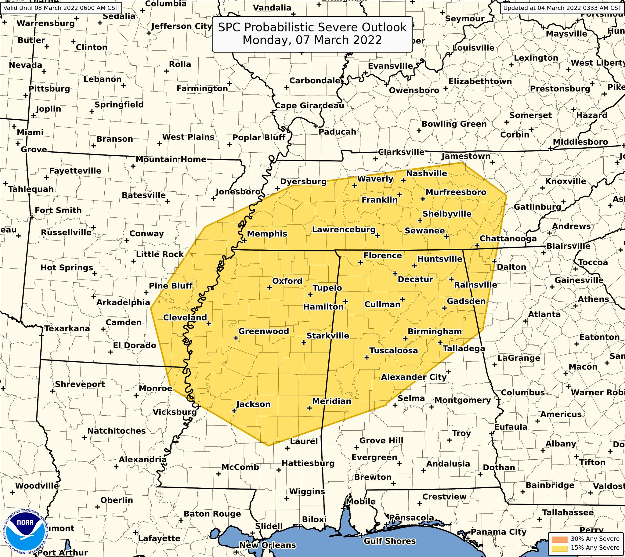
Models at the moment suggest the main threats will come from strong straight line winds and hail; winds aren’t especially favorable for tornadoes. But, this event is still 84 hours away and models can change over the weekend, so watch for updates. For now it looks like the main window for severe weather will come from about 12:00 noon until 8:00 p.m. Rain amounts of 1/2″ to 3/4″ are expected; major flooding issues aren’t expected.
REST OF THE WEEK: The front will stall out around U.S. 80 Tuesday… the best chance of showers will be found over the southern third of the state. North/Central Alabama will be much cooler with a high in the 50s along with a mix of sun and clouds. A wave of low pressure will bring rain to most of Alabama late Tuesday night into Wednesday, followed by a dry day Thursday.
Another cold front will pass through the state Friday… the latest model guidance shows limited moisture and light rain amounts. Then, much colder air settles into the state for the weekend of March 12-13… a good chance temperatures will drop into the 20s across much of North and Central Alabama by Sunday morning March 13. See the Weather Xtreme video for maps, graphics, and more details.
ON THIS DATE IN 1873: The second inauguration of Ulysses S. Grant remains Washington, DC’s, record cold March day. The low was 4 degrees, and by noon with the sunshine, the temperature was 16 degrees. Wind chills were around 30 degrees below zero. The 40 mph winds made his inaugural address inaudible to most on the platform with him.
BEACH FORECAST: Click here to see the AlabamaWx Beach Forecast Center page.
WEATHER BRAINS: Don’t forget you can listen to our weekly 90 minute show anytime on your favorite podcast app. This is the show all about weather featuring many familiar voices, including our meteorologists here at ABC 33/40.
CONNECT: You can find me on all of the major social networks…
Look for my next Weather Xtreme video here by 6:00 a.m. Monday… enjoy the weekend!!