


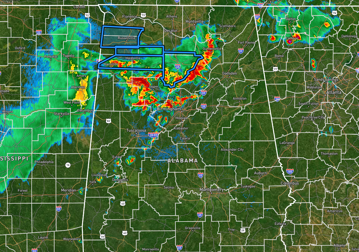
At 7:19 pm, we continue to have rain and thunderstorms moving across the northern half of North/Central Alabama, with the leading edge of these storms moving through portions of Jefferson, Blount, and Marshall counties. These storms continue to produce plenty of cloud to ground lightning and very heavy rainfall, leading to some flooding issues once again.
Flash Flood Warnings are in effect for portions of multiple counties, including Colbert, Franklin, Lawrence, Marion, Winston, Morgan, and Cullman counties.
We continue to have the threat for stronger to severe storms as well, potentially producing hail up to 1 inch in diameter and isolated damaging wind gusts up to 60 mph. A Severe Thunderstorm Watch is in effect until 10 pm for multiple counties in North/Central Alabama. Here is a current list, after a few counties have been added and another few have been cancelled:
North Alabama: Cullman, DeKalb, Jackson, Marshall.
Central Alabama: Bibb, Blount, Calhoun, Cherokee, Etowah, Fayette, Greene, Hale, Jefferson, Lamar, Marion, Pickens, Shelby, St. Clair, Sumter, Tuscaloosa, Talladega, Walker, Winston.
Once we get this round of storms out of the area, our severe threat will be over for the evening, but flooding issues may continue for a few hours later. We’ll keep you updated.



