


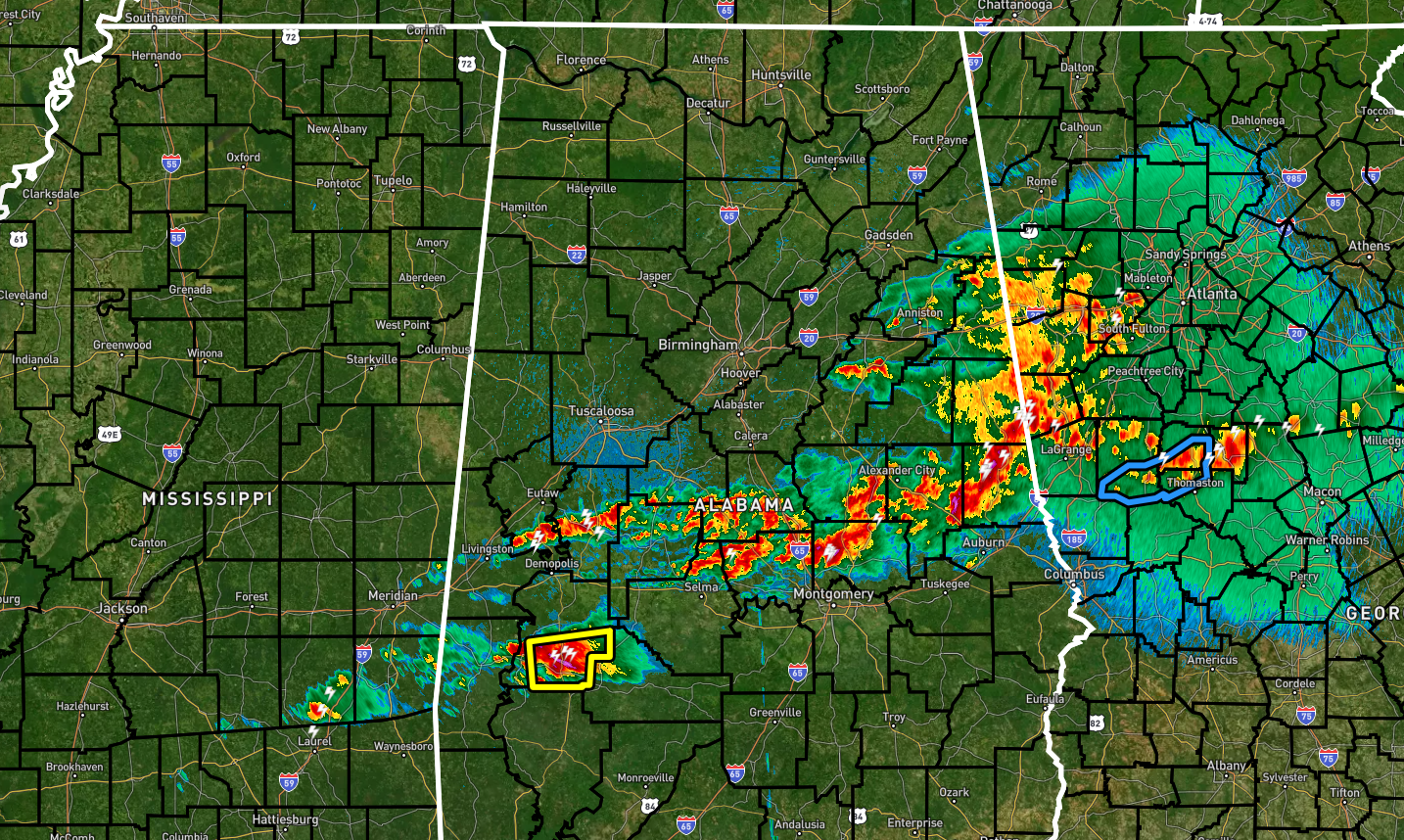
As we approach the 8 am hour, rain and storms are pushing eastward across the extreme eastern and over the south-central parts of Central Alabama. For now, there is only one warning in effect for portions of Marengo County, but the morning has been very active.
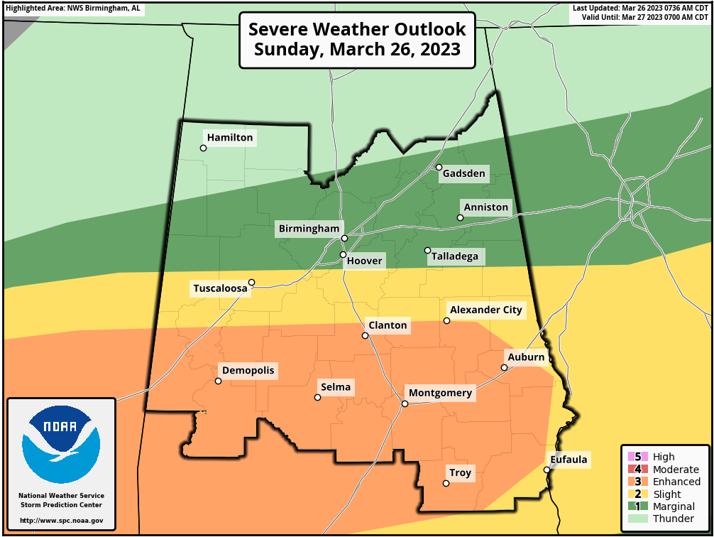
The Enhanced Risk has been expanded across Central Alabama to now include locations along and south of a line from Geiger to Thorsby to Alexander City to Smiths Station. The rest of the southern half of Central Alabama is in a Slight Risk. Much of the northern half of the area is in a Marginal Risk up to as far north as Vernon to Cleveland to Cedar Bluff.
Instability values go from none over the northern half of Central Alabama to as high as 2,000 J/kg in a very short distance not that far south of the I-20 corridor. The threat of a couple of tornadoes are starting to rise, and that is the reason for the Tornado Watch that was issued for the southern parts of Central Alabama. For now, the main threats are from large hail and damaging winds up to 60-70 mph.



