


REST OF TODAY: We are seeing a partly sunny sky today and we will see some scattered showers and storms across Alabama this afternoon. Some strong storms are possible across Southeast Alabama this afternoon where the SPC has a “marginal risk” (level 1 of 5) for severe storms. It is hot today with widespread low to mid 90s, and we note far West and Southwest Alabama are included in a Heat Advisory, as heat index values will be approaching the 105°-108° range.
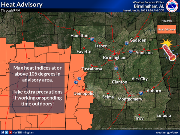
HERE COMES THE HEAT: The upper-ridge “heat dome” to the west will expand eastward this week meaning lower rain chances and hotter temperatures. Some pop-up afternoon showers or storms remain possible daily, but most of Alabama will remain dry through Thursday with those rising heat levels. Highs will hold in the mid 90s tomorrow and Wednesday, followed by upper 90s Thursday and Friday. Some spots could touch the 100 degree mark, and with high humidity levels heat index values will be well over 105°. That means “Heat advisories” will be needed for most of Alabama and the Deep South. We all know how to stay cool during the hot Alabama summer.
Some people have to work outdoors and heat exhaustion and heat stroke are serious. Heat stroke is the most serious heat-related illness. It occurs when the body can no longer control its temperature: the body’s temperature rises rapidly, the sweating mechanism fails, and the body is unable to cool down. When heat stroke occurs, the body temperature can rise to 106°F or higher within 10 to 15 minutes. Just use you common sense and take care of yourself as the heat cranks up this week.
THE ALABAMA WEEKEND: While Saturday and Sunday will be hot, heat levels will be slowly falling, and by next week highs will drop into the 87-92 degree range, much more tolerable. We will have scattered, random showers and thunderstorms around during the afternoon and evening hours, mostly in the 2-10PM time frame.
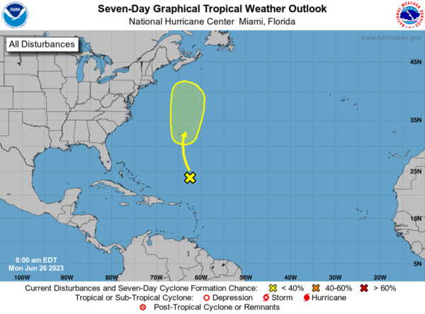
IN THE TROPICS: A surface trough of low pressure, associated with the remnants of Cindy, is producing disorganized showers and thunderstorms more than 500 miles to the south-southeast of Bermuda. While strong upper-level winds are expected to prevent redevelopment of this system over the next day or two, environmental conditions could then become a little more favorable for some gradual redevelopment during the latter part of this week. This system should move generally northward into the northwestern Atlantic ocean, passing near Bermuda on Thursday. Formation chance through 7 days…low…30 percent.
BEACH FORECAST CENTER: Get the latest weather and rip current forecasts for the beaches from Fort Morgan to Panama City on our Beach Forecast Center page. There, you can select the forecast of the region that you are interested in visiting.
CONTIGUOUS TEMPERATURE EXTREMES: Over the last 24 hours, the highest observation was 117F at Rio Grande Village, TX. The lowest observation was 28F at Bryce Canyon, UT.



