


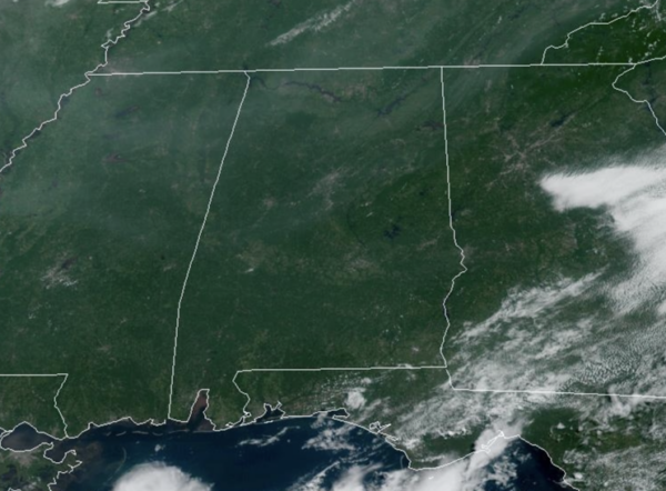
HOT, BUT NOT HUMID: It was a pleasant late July morning across much of North/Central Alabama as a drier air mass remains in place. The sky is sunny today and afternoon highs are in the low 90s for most locations, which are right where they should be for this time of year.
USA BRIEF: The main story this week will be the continued excessive summer heat across the U.S. For much of July hot dangerous conditions have been the normal in parts of the West, Texas and Florida. These summer conditions will build and expand across the Eastern two-thirds of the country this week, starting in the north-central states and Plains.
REST OF WEEK: The upper-ridge will remain in place, suppressing our rain chances, but also the relatively dry air will remain in place much of this week. The days will be mainly dry and sunny with highs in the mid 90s, and by the end of the week we could see upper 90s. Late in the week, moisture levels will slowly increase and we will mention the chance of a few pop-up afternoon showers and storms by Friday, but these will remain widely spaced. Overall, a very quiet weather for this last full week of July.
WEEKEND AND BEYOND: The quiet summer pattern continues as the ridge stays in place. Afternoon storms will remain isolated, highs will be in the mid to upper 90s, lows in the 70s. Rain chances will be in the 10-20% range daily.
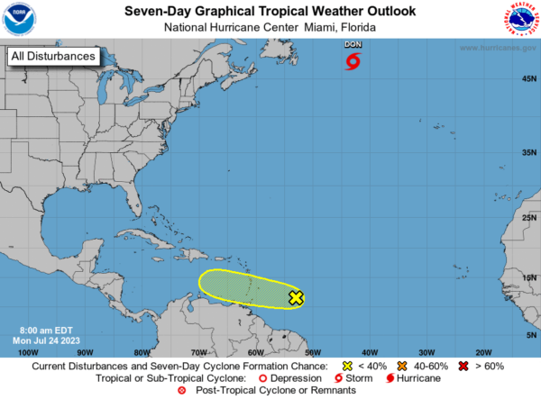
IN THE TROPICS: Don will dissipate later tonight in the far North Atlantic. Elsewhere, we are still watching Invest 95-L east of the Windward Islands. A broad area of low pressure associated with a tropical wave is located several hundred miles east of the Windward Islands. While this system has not become significantly better organized since yesterday, some slow development remains possible during the next couple of days while it moves westward across the tropical Atlantic and into the eastern Caribbean Sea. Regardless of development, locally heavy rains and strong gusty winds are possible across portions of the Lesser Antilles during the next day or two. Environmental conditions are expected to become unfavorable for development of this system by the middle of the week. Formation chance through 7 days…low…20 percent.
BEACH FORECAST CENTER: Get the latest weather and rip current forecasts for the beaches from Fort Morgan to Panama City on our Beach Forecast Center page. There, you can select the forecast of the region that you are interested in visiting.
WORLD TEMPERATURE EXTREMES: Over the last 24 hours, the highest observation outside the U.S. was 121.3F at Ahwaz, Iran. The lowest observation was -111.8F Dome C, Antarctica.
CONTIGUOUS TEMPERATURE EXTREMES: Over the last 24 hours, the highest observation was 124F at Stovepipe Wells, CA. The lowest observation was 32F at Chateau, MT.



