


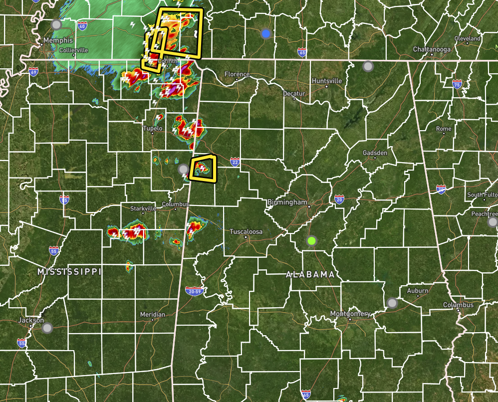
As of 6:21 pm, scattered storms are moving eastward from Mississippi and have started crossing the state line into the western portions of Central Alabama. Severe T-Storm Warnings have been issued on several of those storms, including the one over Lamar County. This is nearly right on the money to what the HRRR modeled earlier today when I posted the midday update, it is occurring about 90 minutes earlier than expected.
Instability rates are crazy high, running in-between 2500 to over 6000 J/kg, so these storms will have plenty of fuel to feed off of as they move deeper into the area. Downdraft CAPE values are high as well, in the 900 to 1300 J/kg, so that means that damaging winds will be possible if any of these storms strengthen to severe levels.
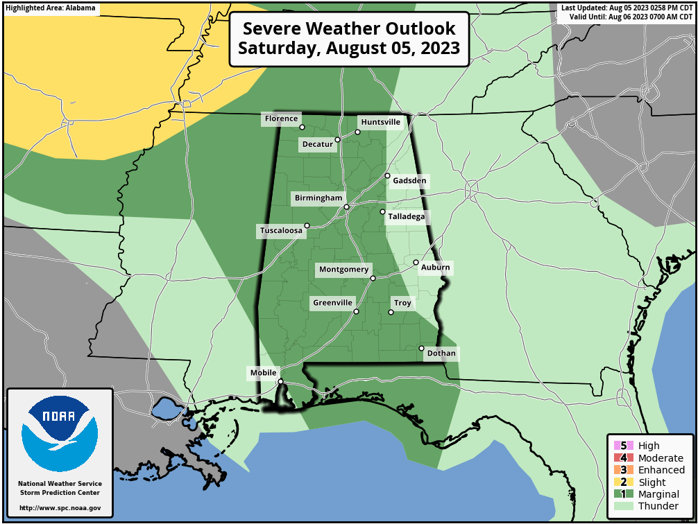
The Marginal Risk for severe storms has not changed for North and Central Alabama, with everyone west of a line from Scottsboro to Gadsden to Alexander City to just west of Clayton in Barbour County. While tornadoes and hail do not look like to be a threat with tonight’s activity, you will still need to get into a safer place inside your residence, just in case winds cause damage to the structure.
Much of the activity will be out of the area by 2 am, but models are hinting at redevelopment over the Tennessee Valley and keeping portions of North Alabama stormy through the mid-morning hours.



